From Geospatial Analytics for Urban Planning
Jump to navigation
Jump to search
Part One: Thematic Mapping
Public Education Institutions
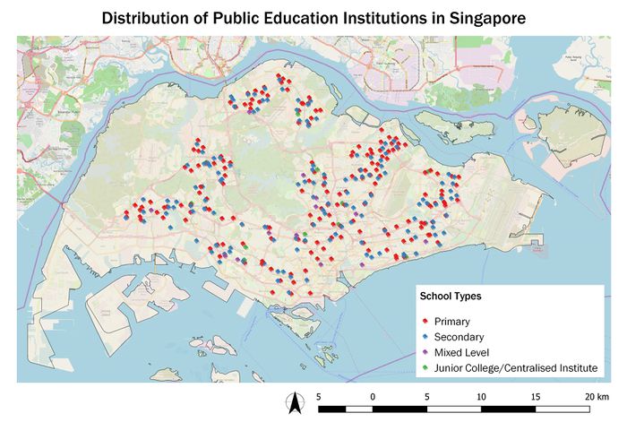
Data Source: data.gov.sg / File: general-information-of-schools.csv
Road Network System
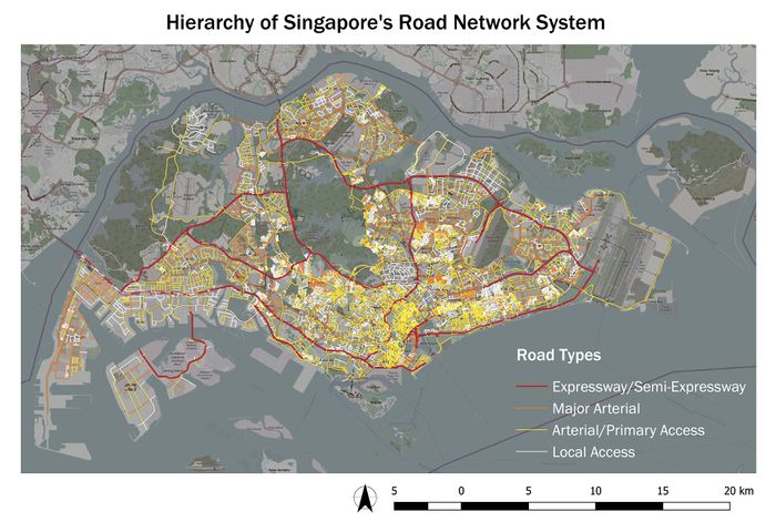
Data Source: mytransport.sg / File: RoadSectionLine.shp
2014 Master Plan Landuse
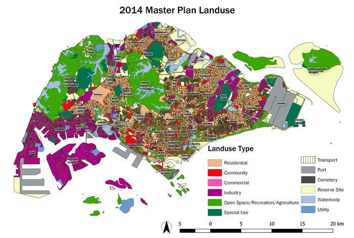
Data Source: data.gov.sg / File: G_MP14_LAND_USE_PL.shp
Part Two: Choropleth Mapping
Aged population (+65) in 2010 and 2018
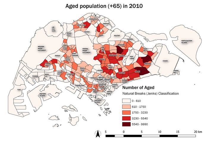
Data Source: data.gov.sg / File: SUBZONE_AGE_GENDER_2010.shp
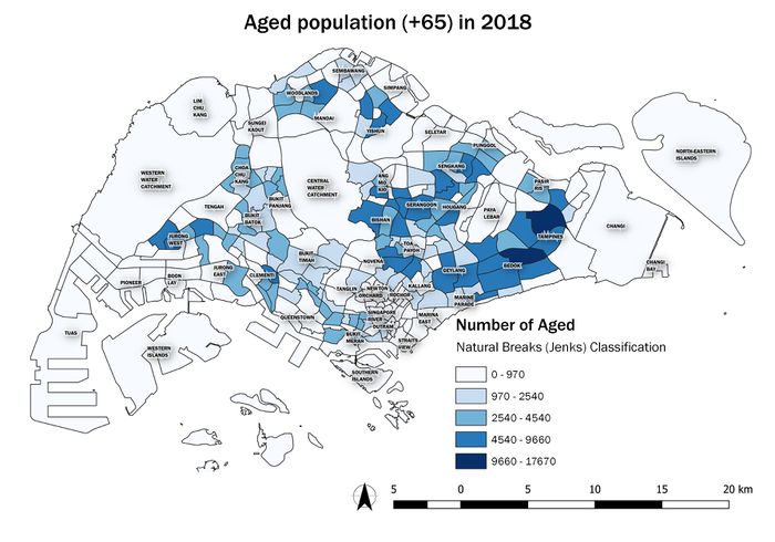
Data Source: singstat.gov.sg / File: SGResidentPopulationAgeGroupSex_2018.csv
Proportional of aged population in 2010 and 2018
Percentage change of aged population between 2010 and 2018
References & Acknowledgements


