SMT201 AY2019-20G1 Ex2 LeeHuiYun
Objective
The objective of this study is to identify a suitable location in the Gombak planning subzone with a contiguous area of at least 10,000m2 to build a national Communicable Disease Quarantine Centre. This study would take the following factors into account while selecting the location.
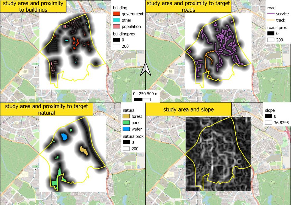
- Health risk factor: Study of building by using the location of building to find building proximity to identify an area that is furthest away from the population to reduce the risk of spreading disease.
- Accessibility factor: Study of the road by using the location of the road to find road proximity to identify the area that is closed to the road for easy transportation. Road namely: service roads and tracks
- Natural conservation factor: Study of natural features by using location of natural to find natural proximity to identify area that is away from forested land, park, and water.
- Economic factor: Study of slope by using slope and elevation of Gombak to identify the gentlest slope to minimized construction cost of cut-and-fill.
Study Area
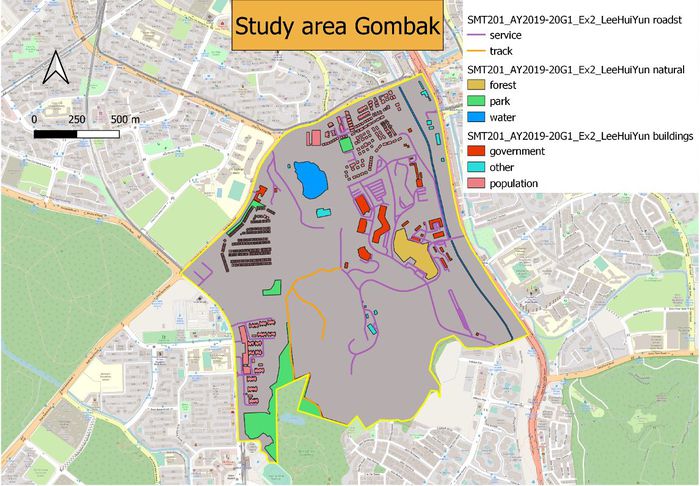
The above map shows the study area which is Gombak with the factors that I need to take into account.
Health risk factor (Building):
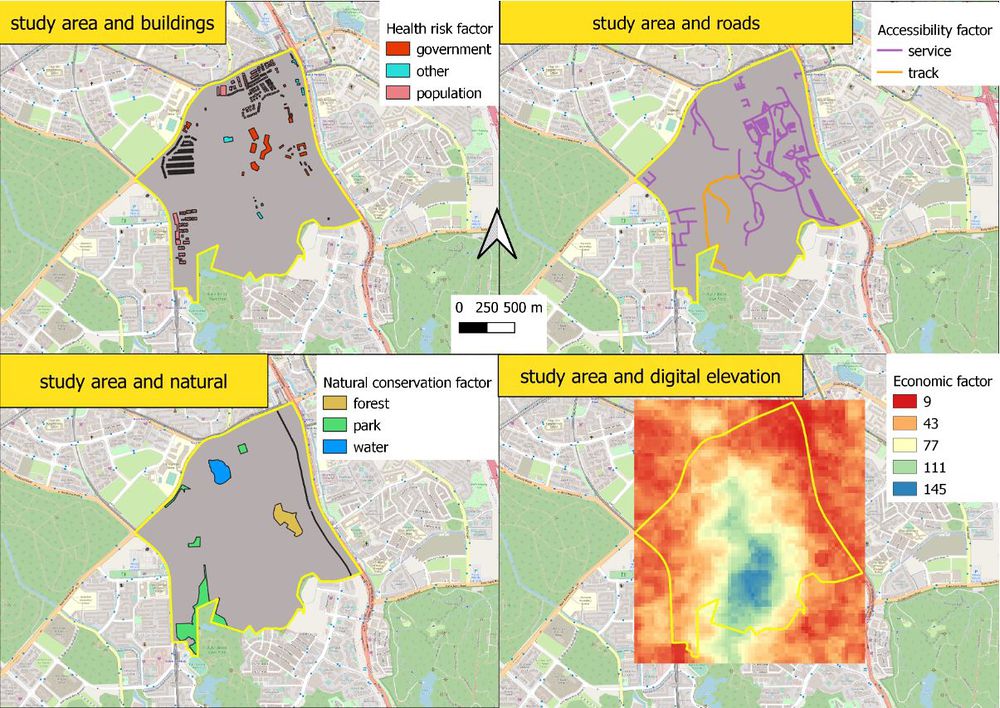
For building, I have 3 main categories. Mainly government, other and population. Under government, there are military camp and fire station. Under other, there are public transport and religious place. Under population, there are residential areas. So, from these 3 categories, I can observe that even though all building has the probability of humans’ activity but some of them have a higher probability. Ranging from population, other and government in descending of humans’ activity. As places like government such as military camp, if there is a disease outbreak the government would stop any army personnel from training.
Accessibility factor (Road):
For road, I have only focus on the service road and track which is my target type of road. There is a total of 186 service roads in Gombak which spread widely across the subzone and 2 tracks which is around the southern part of Gombak.
Natural conservation factor (natural features):
For natural features, there are 3 main categories which are forest, park, and water in Gombak. There is a total of 1 forest, 4 parks, and 3 water. Forest usage might be for military training located near the military camp on the eastern side of Gombak which is restricted from the resident. 4 parks are located near the residential area for residents of Gombak leisure purpose. 1 water is located in the forest which might be a lake and the rest is one kennel located at the eastern side of Gombak.
Economic factor (Elevation):
For Elevation, I can observe that Gombak is steeper in the Central area which is in blue and the steep become gentle when it nearer to the border of Gombak which is in red.
Proximity
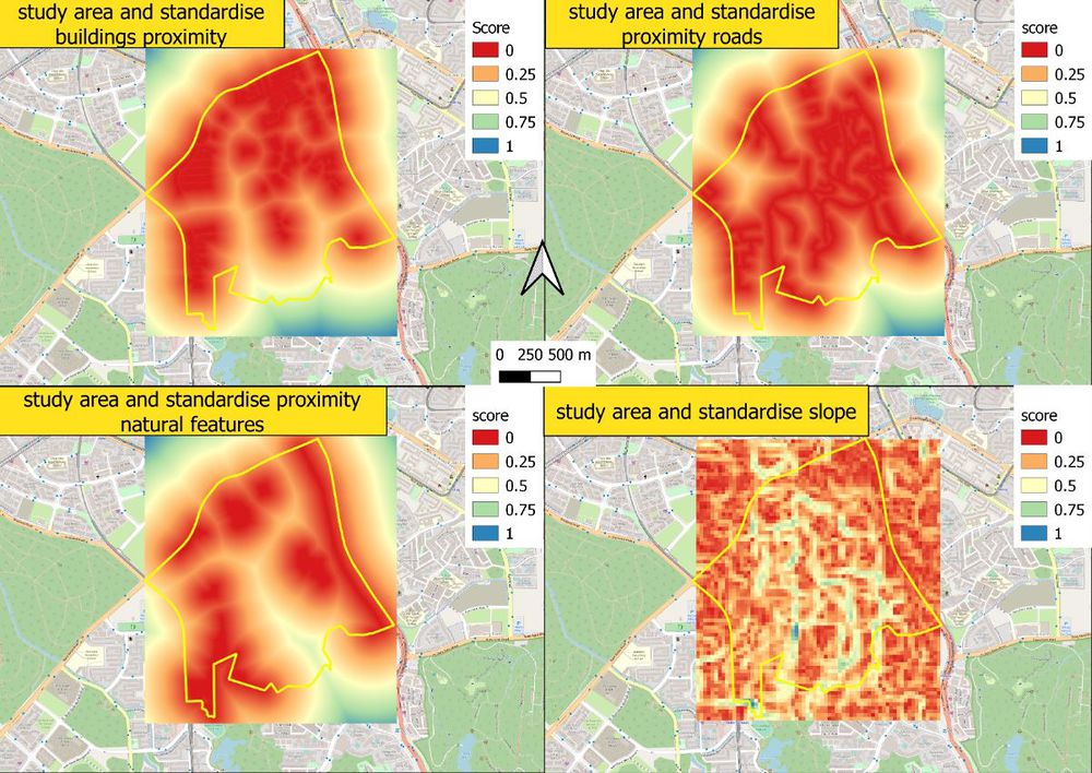
Criterion scores


