G1-Group01
Contents
Proposal
Project Motivation
Project Motivation
Singapore is a land scarce island with a total area of 721.5 square kilometres that accommodates to approximately 5.8 million people. This makes land use planning in Singapore a crucial process that not only requires meticulous planning but also the need to follow a set of standard procedures. Different areas of land need to cater for different facilities while taking into consideration the changing population demographics. Using systems such as Geospatial technology and relevant data sources, we can analyse the change in characteristics of Serangoon and improve the efficiency of urban planning process.
Project Objective
Project Objective
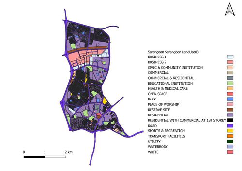
As mentioned above, a set of standard procedures should be followed. Before making any recommendations to the current land use of Serangoon, its essential for us to compare the changes. On top of this, we will need to take into consideration several factors, from the residents needs to current facilities in the area itself, before we are able to begin making changes to the area. Therefore, our project aims to be a mini model of the correct method of carrying out urban planning.
In this project, we will be analysing the following areas:
- Transportation
- Child-care Centres
- Eldercare Centres
We will also be studying 3 main groups of population:
- The elderly (aged 65 and above)
- The young (aged 0-4)
- The economic active (aged 25-64)
About Serangoon
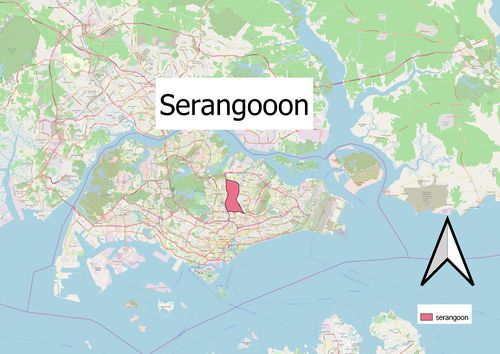
Serangoon is named after a bird commonly found in the riverine swamps around the Serangoon River and is located in the central part of Singapore, within the North-eastern region. It mainly consists of residential buildings with a total land area of 10.1km² and total population size of 116,310 as of June 2019. The area attracted more people after Nex, a shopping mall connected to a bus interchange, and the Serangoon Circle Line MRT station were built in 2010.
Project Data Source
Data Source
| Data Name | Data Format | Source | |
|---|---|---|---|
| Landuse (2008/2014/2019) | |||
| URA Planning Areas (2008) | Shape files | https://data.gov.sg/dataset/master-plan-2008-planning-area-boundary-no-sea | |
| URA Planning Areas (2014) | Shape files | https://data.gov.sg/dataset/master-plan-2014-planning-area-boundary-web | |
| URA Planning Areas (2019) | Reference | https://www.ura.gov.sg/Corporate/Planning/Draft-Master-Plan-19 | |
| Population | |||
| Population (2015) | CSV | https://www.singstat.gov.sg/find-data/search-by-theme/population/geographic-distribution/latest-data | |
| Population (2019) | CSV | https://www.singstat.gov.sg/-/media/files/publications/population/population2019.pdf | |
| Profession | CSV | https://www.tablebuilder.singstat.gov.sg/publicfacing/createSpecialTable.action?refId=8321 | |
| Education & Healthcare Services | |||
| Childcare Services | Shapefile | https://data.gov.sg/dataset/listing-of-centres | |

