SMT201 AY2018-19T1 EX1 Nigel Poon Wei Chun

From Geospatial Analytics for Urban Planning
Revision as of 21:48, 15 September 2019 by Nigel.poon.2018 (talk | contribs)
Jump to navigation Jump to search

Thematic Mapping

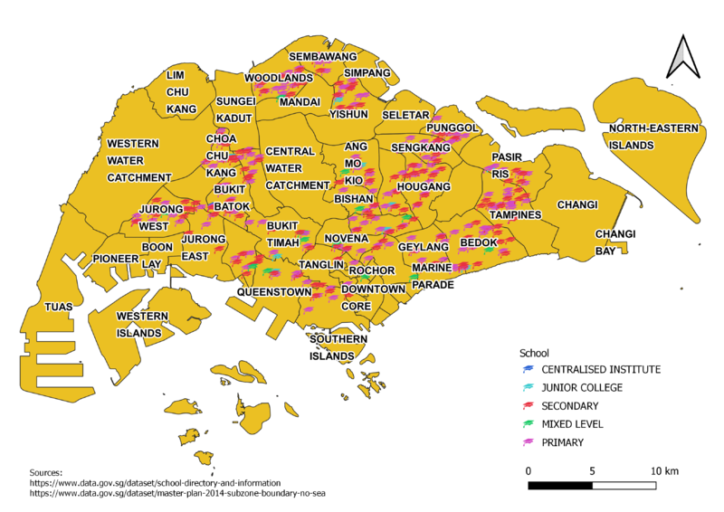
Level of Schools

NigelSchool.png

The Geographical locations were derived using the one map api . The Schools fall under 5 catergories with different colors and symbolized by the education SVG marker. Primary and secondary schools dominate as the majority of schools in Singapore.
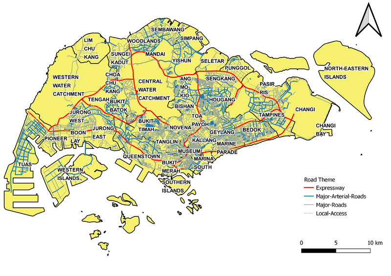
Road Hierarchy Map

NigelRoadTheme.png

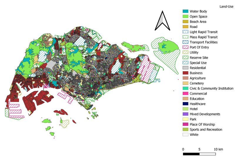
Master Plan Land use

NigelLandUse.png

Choropleth Mapping

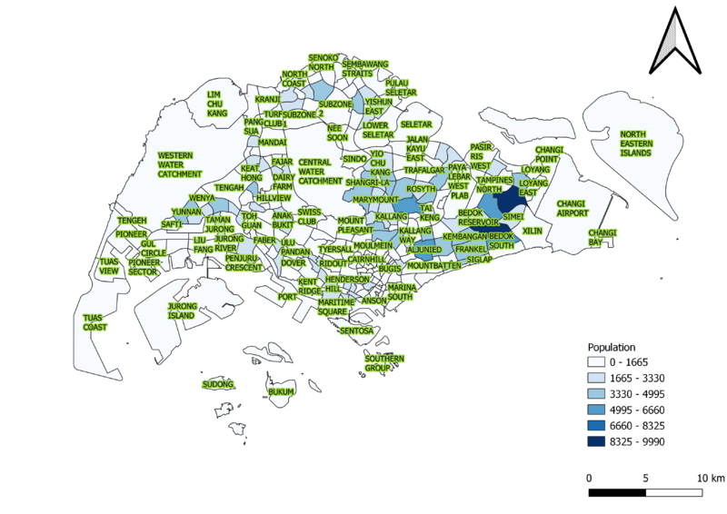
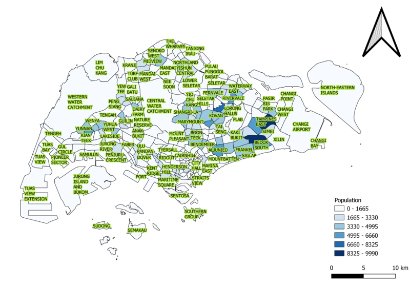
Population Aged 65+

2010

NigelAgedPopulation2010.png

2018

NigelAgedPopulation2018.png

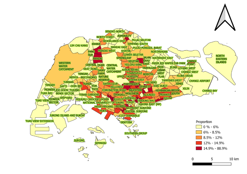
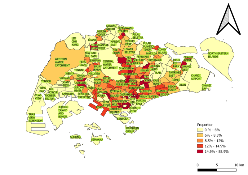
Proportion Aged 65+

2010

NigelAgedProportion2010.png

2018

NigelAgedProportion2018.png

Percentage Change between 2010 and 2018

NigelAgedPopulationChange.png