Difference between revisions of "SMT201 AY2019-20T1 EX2 Lee Yuan Kang"
Jump to navigation
Jump to search

Yklee.2017 (talk | contribs) |
Yklee.2017 (talk | contribs) |
||
| Line 8: | Line 8: | ||
*the study area and the target natural features, | *the study area and the target natural features, | ||
*the study area and digital elevation | *the study area and digital elevation | ||
| + | |||
| + | === Map view with Roads === | ||
| + | There are many types of road in Gombak Subzone, I have filtered out the service and track roads for accessibility. Comparing the two types of roads, there are more service type roads than track types roads. | ||
| + | |||
| + | === Map view with Buildings === | ||
| + | There are different types of building in Gombak subzone. However, majority of the building types are null value hence I did not split based on types as the null types will not value add to any analysis. | ||
| + | |||
| + | === Map view with Natural Areas === | ||
| + | There are different types of natural areas and I have split them into their types, they are forests, parks and water. | ||
| + | |||
| + | === Map view with Digital Elevation === | ||
| + | I have splitted the Elevation to 5 classes The steeper the class is the more we should avoid it as the development cost will be higher. | ||
== Gombak Subzone Area (Proximity) == | == Gombak Subzone Area (Proximity) == | ||
Revision as of 21:27, 10 November 2019
Contents
Gombak Subzone Area

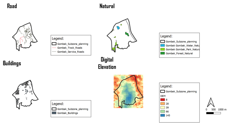
The image above shows the 4 different views of Gombak study area.
- the study area and the target roads,
- the study area and buildings,
- the study area and the target natural features,
- the study area and digital elevation
Map view with Roads
There are many types of road in Gombak Subzone, I have filtered out the service and track roads for accessibility. Comparing the two types of roads, there are more service type roads than track types roads.
Map view with Buildings
There are different types of building in Gombak subzone. However, majority of the building types are null value hence I did not split based on types as the null types will not value add to any analysis.
Map view with Natural Areas
There are different types of natural areas and I have split them into their types, they are forests, parks and water.
Map view with Digital Elevation
I have splitted the Elevation to 5 classes The steeper the class is the more we should avoid it as the development cost will be higher.
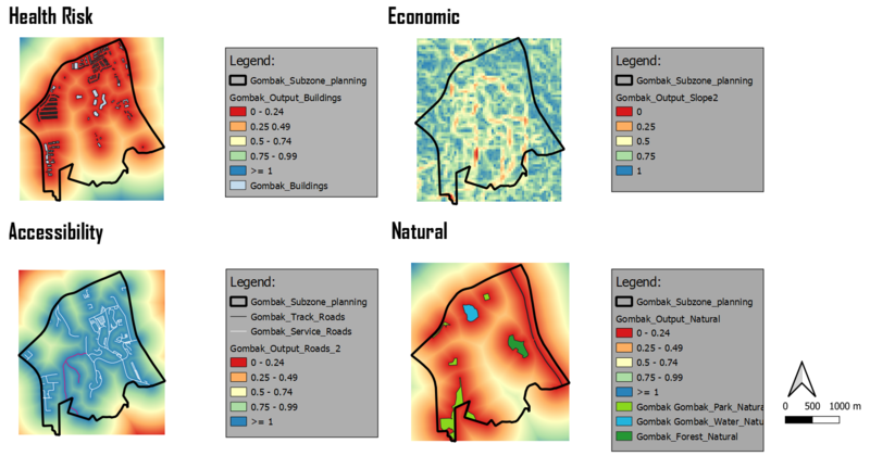
Gombak Subzone Area (Proximity)

Gombak Subzone Area (Criterion Scores)
