Difference between revisions of "SMT201 AY2019-20T1 EX2 Gui yuqi"
Jump to navigation
Jump to search
| Line 18: | Line 18: | ||
[[File:Suitability Map V2.png|1000px|frameless]] | [[File:Suitability Map V2.png|1000px|frameless]] | ||
<br> | <br> | ||
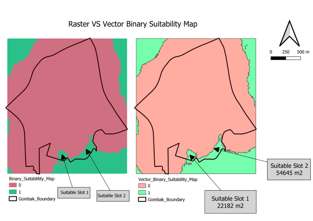
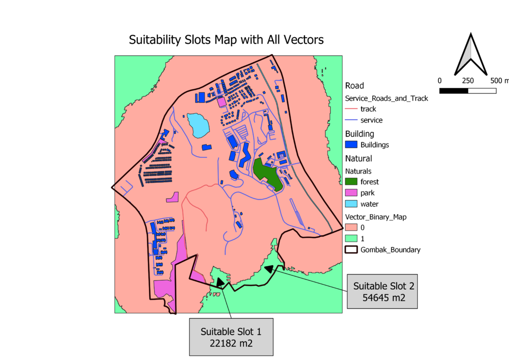
| − | == Suitability land lots layout == | + | == Part Five - Suitability land lots layout == |
<br> | <br> | ||
[[File:Suitability Binary.png|1000px|center|frameless]] | [[File:Suitability Binary.png|1000px|center|frameless]] | ||
| + | <br> | ||
| + | [[File:Finallll.png|1000px|center|frameless]] | ||
Revision as of 21:13, 10 November 2019
Contents
- 1 Part One - Map Views w Roads, Buildings, Natural Areas and Elevation
- 2 Part Two Proximity Raster w Roads, Buildings, Natural Areas and Slope Raster layer
- 3 Part Three - Criterion Scores for various Layers
- 4 Part Four - Analytical Hierarchical Process input matrix
- 5 Part Five - Suitability land lots layout
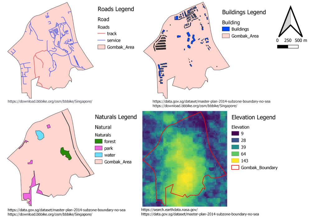
Part One - Map Views w Roads, Buildings, Natural Areas and Elevation

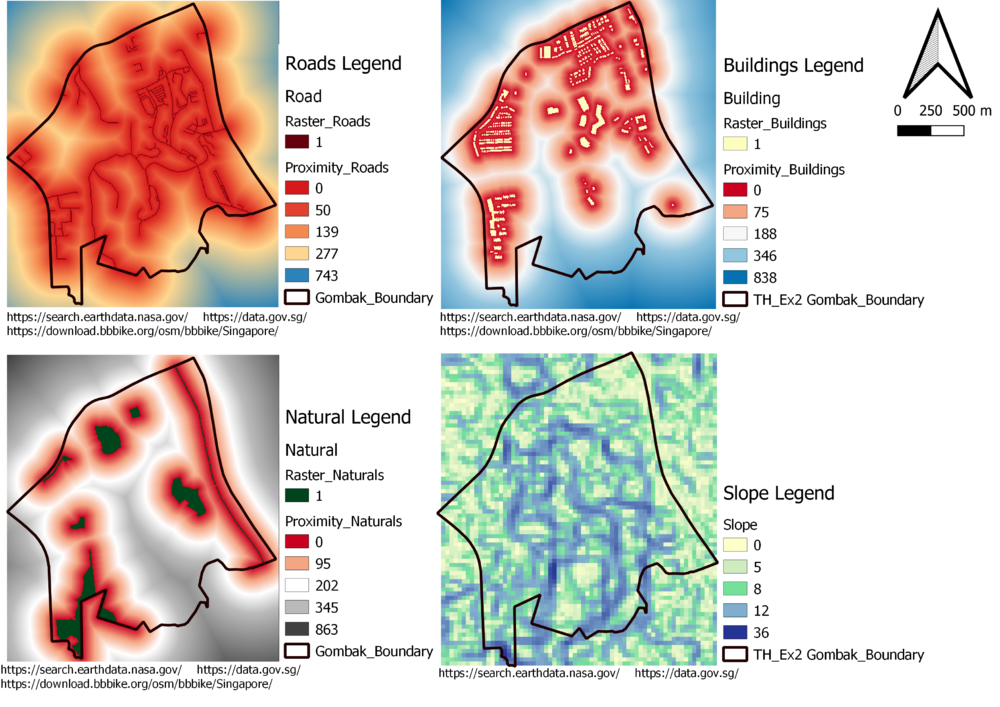
Part Two Proximity Raster w Roads, Buildings, Natural Areas and Slope Raster layer

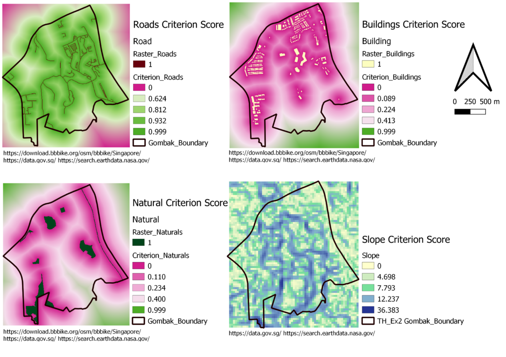
Part Three - Criterion Scores for various Layers

Part Four - Analytical Hierarchical Process input matrix


Part Five - Suitability land lots layout

