Difference between revisions of "SMT201 AY2019-20T1 EX2 Tan Zi Ying"
Jump to navigation
Jump to search
Zy.tan.2018 (talk | contribs) |
Zy.tan.2018 (talk | contribs) |
||
| Line 29: | Line 29: | ||
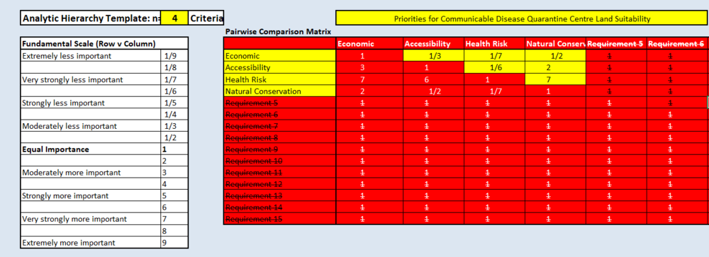
== Analytical Hierarchical Process Input Matrix and Result Report == | == Analytical Hierarchical Process Input Matrix and Result Report == | ||
| − | + | [[ File:AHP1.png|1000px|center|AHP_input_maxtrix]] | |
== Comments on the Suitable Land Lot(s) Identified == | == Comments on the Suitable Land Lot(s) Identified == | ||
Revision as of 15:35, 10 November 2019
Contents
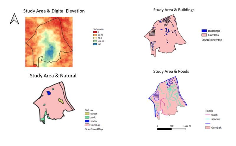
Building a national Communicable Disease Quarantine Centre
- Economic Factor (study area and digital elevation)
- Accessibility Factor (study area and target roads)
- Health Risk Factor (study area and buildings)
- Natural Conservation Factor (study area and natural)

source: Master Plan 2014 Subzone Boundary from URA from data.gov.sg. Roads, buildings and natural features data from OpenStreetMap (OSM) data sets from BBBike@Singapore. ASTER Global Digital Elevation Model (GDEM) dataset jointly prepared by NASA and METI, Japan from NASA’s EarthData Search site complied by Professor Kam
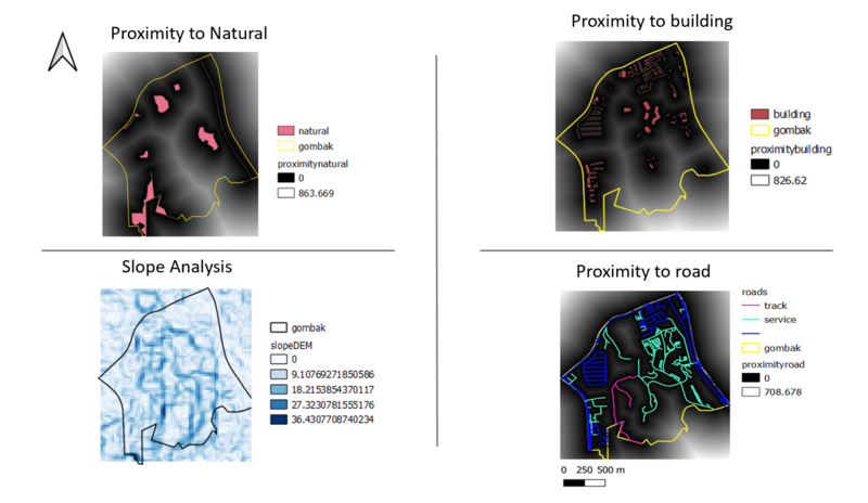
Proximity Analysis
- the study area and proximity to target roads layer
- the study area and proximity to buildings layer
- the study area and proximity to target natural features layer
- the study area and slope layer

source: Master Plan 2014 Subzone Boundary from URA from data.gov.sg. Roads, buildings and natural features data from OpenStreetMap (OSM) data sets from BBBike@Singapore. ASTER Global Digital Elevation Model (GDEM) dataset jointly prepared by NASA and METI, Japan from NASA’s EarthData Search site complied by Professor Kam
Criterion Scores of each Factor Layers
Analytical Hierarchical Process Input Matrix and Result Report
