Difference between revisions of "SMT201 AY2019-20T1 EX2 Tay Jing Wen"
Jump to navigation
Jump to search
| Line 28: | Line 28: | ||
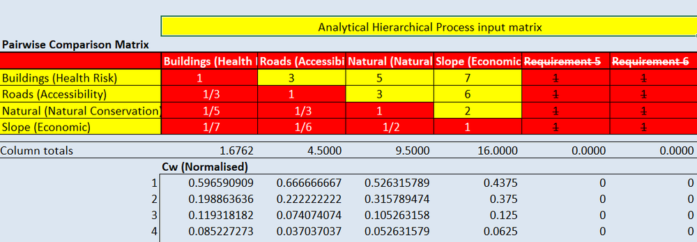
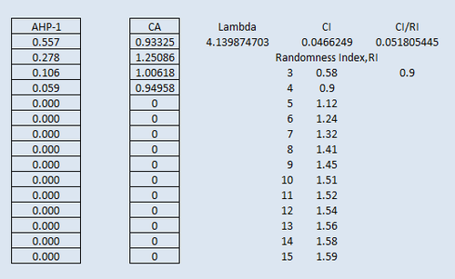
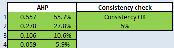
== PART 4: Analytical Hierarchical Process Input Matrix == | == PART 4: Analytical Hierarchical Process Input Matrix == | ||
| − | + | [[File:Matrix.png|1000x1000px|frameless|center]]<br> | |
| + | [[File:Matrix2.png|500x500px|frameless|center]]<br> | ||
| + | [[File:Matrix3.png|500x500px|frameless|center]] | ||
<br><br> | <br><br> | ||
Revision as of 14:18, 10 November 2019
Contents
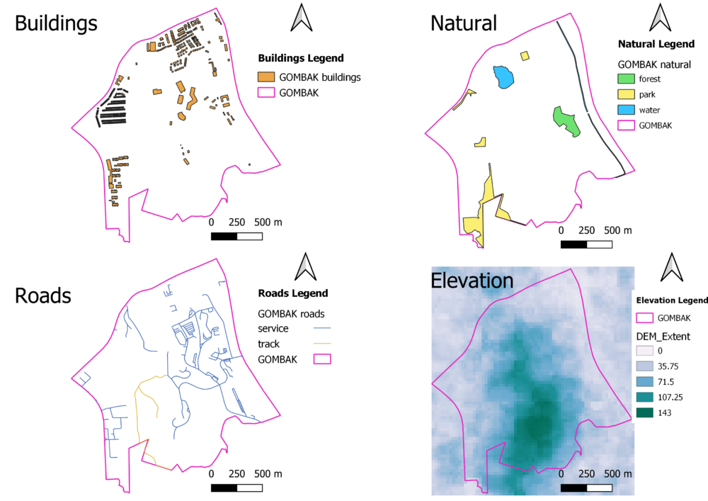
PART 1: Gombak and the 4 Target Views

Description
Buildings:
Natural:
Roads:
Digital Elevation:
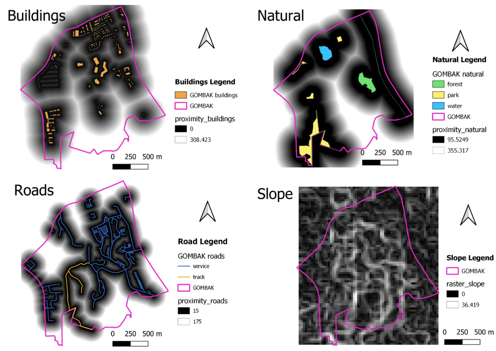
PART 2: Gombak and the 4 Proximity Views

Description
Buildings:
Natural:
Roads:
Slope:
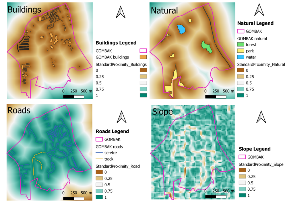
PART 3: Criterion Score

Description
To apply Standardization with minmax, the minimum and maximum values are retrieve through Raster Layer Statistics. The following shows the formula and values to standardardize each layer.
Buildings: ("StandardProximity_Buildings@1" - 0) / (838.4658813476562 - 0)
Natural: ("StandardProximity_Natural@1" - 0) / (863.6694946289062 - 0)
Roads: ("StandardProximity_Roads@1" - 0) / (743.303466796875 - 0)
Slope: ("StandardProximity_Slope@1" - 0) / (36.41904830932617 - 0)
PART 4: Analytical Hierarchical Process Input Matrix


PART 5: Suitability Land Lot