Difference between revisions of "SMT201 AY2019-20G1 Ex2 Kang Hui Yun"
Jump to navigation
Jump to search
| Line 1: | Line 1: | ||
== Part 1: Base Map Views == | == Part 1: Base Map Views == | ||
| − | + | [[File:KangHuiYun 4 Views Base.png|border|1200px|center]] | |
| − | + | === Buildings === | |
| + | |||
| + | Buildings are not evenly distributed in the area—most of them are situated around the boundary of Gombak and exist in the form of clusters. More specifically, there are huge and dense concentration of buildings lying on the north, northwest and southwest area, while the central has fewer but bigger buildings built in a sparser manner. The south and southeast counterparts are rather remote, with only one building seen in southeast. | ||
== Part 2: Proximity/Slope Map Views == | == Part 2: Proximity/Slope Map Views == | ||
=== Test === | === Test === | ||
Revision as of 15:52, 9 November 2019
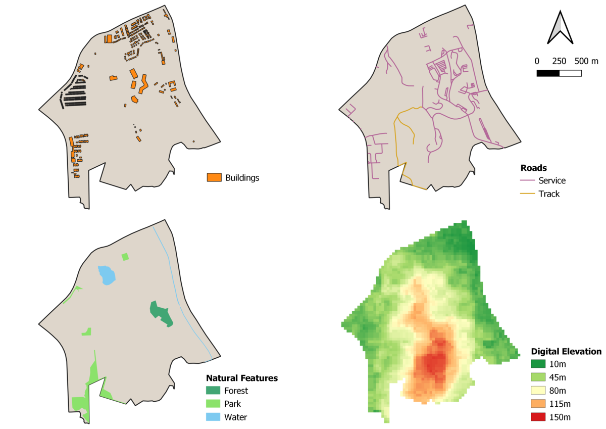
Part 1: Base Map Views

Buildings
Buildings are not evenly distributed in the area—most of them are situated around the boundary of Gombak and exist in the form of clusters. More specifically, there are huge and dense concentration of buildings lying on the north, northwest and southwest area, while the central has fewer but bigger buildings built in a sparser manner. The south and southeast counterparts are rather remote, with only one building seen in southeast.