Difference between revisions of "SMT201 AY2019-20G2 Ex2 Ng Poh Yeng"
Jump to navigation
Jump to search
| Line 6: | Line 6: | ||
Gombak Target Buildings displays all the buildings that are in subzone Gombak.<br> | Gombak Target Buildings displays all the buildings that are in subzone Gombak.<br> | ||
Gombak Target Nature displays all the natural features ranging from all available parks, water features and green site. <br> | Gombak Target Nature displays all the natural features ranging from all available parks, water features and green site. <br> | ||
| − | Gombak Elevation displays the slope elevation in subzone Gombak. The dark purple shades are lower-lying ground while the lighter the colour, the higher the ground level. <br> | + | Gombak Target Elevation displays the slope elevation in subzone Gombak. The dark purple shades are lower-lying ground while the lighter the colour, the higher the ground level. <br> |
| + | |||
| + | <div style="background: #E59FED; padding: 20px; line-height: 0.3em; text-indent: 0px;letter-spacing:0.01em;font-size:26px"><font color=#000000 face="Arial"><b>Study Area</b></font></div> | ||
| + | |||
| + | [[File:Task2 v2.png|frameless | 800px| center]] | ||
Revision as of 13:57, 9 November 2019
Study Area

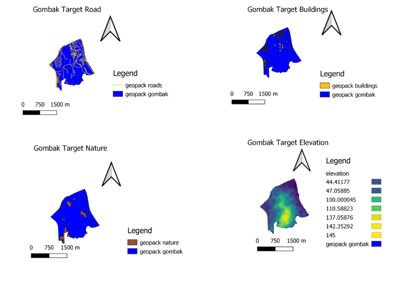
Gombak Target Road displays the major and minor roads of subzone Gombak against the study area.
Gombak Target Buildings displays all the buildings that are in subzone Gombak.
Gombak Target Nature displays all the natural features ranging from all available parks, water features and green site.
Gombak Target Elevation displays the slope elevation in subzone Gombak. The dark purple shades are lower-lying ground while the lighter the colour, the higher the ground level.
Study Area
