Difference between revisions of "SMT201 AY2019-20G1 Ex2 Luo Junru"
| Line 7: | Line 7: | ||
The site should be away from buildings to prevent the disease from spreading to the population.<br /> | The site should be away from buildings to prevent the disease from spreading to the population.<br /> | ||
4. Natural conservation factor:<br /> | 4. Natural conservation factor:<br /> | ||
| − | The site should be away from natural areas because natural sites are usually far away from roads, thus if the site is near natural areas, it may be inaccessible also. <br /> | + | The site should be away from natural areas because natural sites are usually far away from roads, thus if the site is near natural areas, it may be inaccessible also. <br /><br /><br /> |
| + | |||
| + | The data used for this assignment are retrieved from the following websites: <br /> | ||
| + | • Master Plan 2014 Subzone Boundary from data.gov.sg.<br /> | ||
| + | • Roads, buildings and natural features data from OpenStreetMap (OSM) via BBBike@Singapore.<br /> | ||
| + | • ASTER Global Digital Elevation Model (GDEM) dataset jointly prepared by NASA and METI, Japan from NASA’s EarthData Search site.<br /> | ||
| + | |||
Revision as of 10:26, 9 November 2019
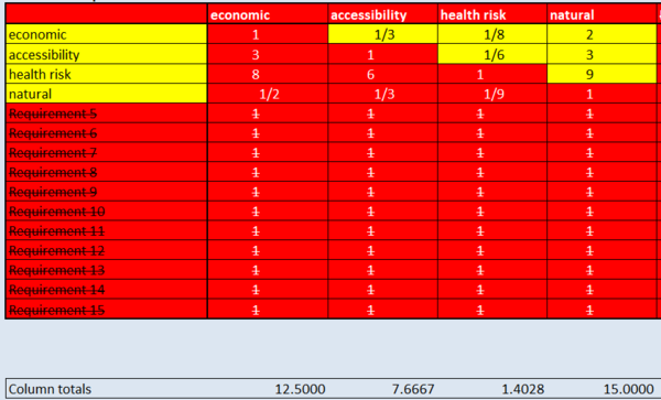
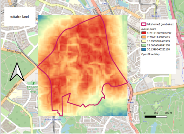
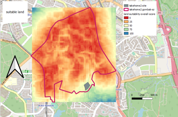
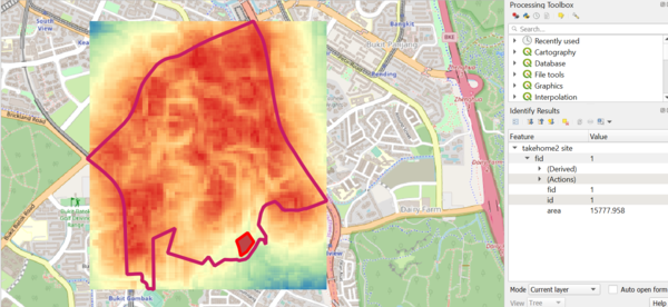
The objective is to identify a location suitable for building a national Communicable Disease Quarantine Centre at the Gombak planning subzone. In order to examine potential site suitability, 4 factors are taken into consideration:
1. Economic:
Steep slope should be avoided because it is rather expensive to build a site there as compared to a flat ground.
2. Accessibility:
The site should be close to road to facilitate the construction process.
3. Health risk factor:
The site should be away from buildings to prevent the disease from spreading to the population.
4. Natural conservation factor:
The site should be away from natural areas because natural sites are usually far away from roads, thus if the site is near natural areas, it may be inaccessible also.
The data used for this assignment are retrieved from the following websites:
• Master Plan 2014 Subzone Boundary from data.gov.sg.
• Roads, buildings and natural features data from OpenStreetMap (OSM) via BBBike@Singapore.
• ASTER Global Digital Elevation Model (GDEM) dataset jointly prepared by NASA and METI, Japan from NASA’s EarthData Search site.
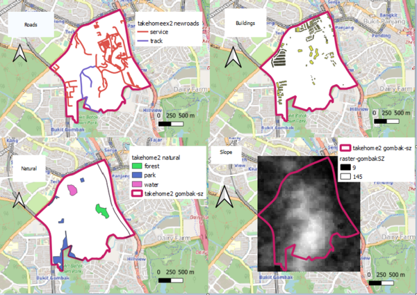
Part 1
Target roads, buildings, target natural features and digital elevation
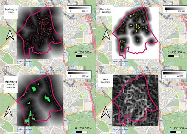
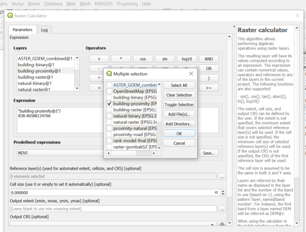
Part 2
Proximity analysis
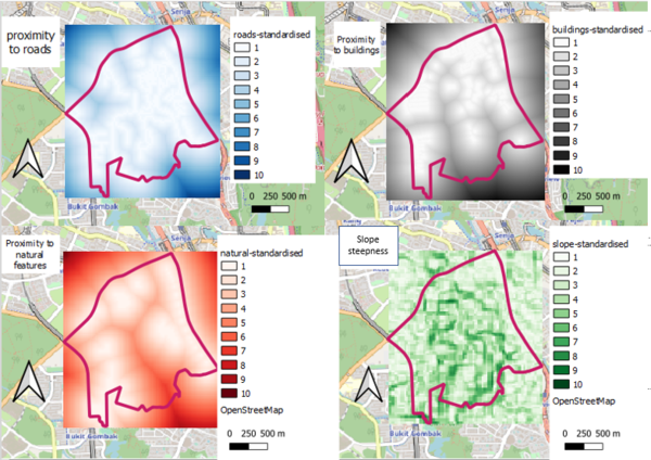
Part 3
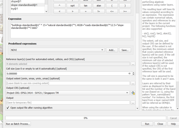
Criterion scores
Reference: Prof Kam’s Lesson 9: GIS Modelling for Urban Planning Support ppt notes
