Difference between revisions of "SMT201 AY2019-20G1 Ex2 Kning Kit Siang"
Jump to navigation
Jump to search


Kskning.2018 (talk | contribs) |
Kskning.2018 (talk | contribs) |
||
| Line 38: | Line 38: | ||
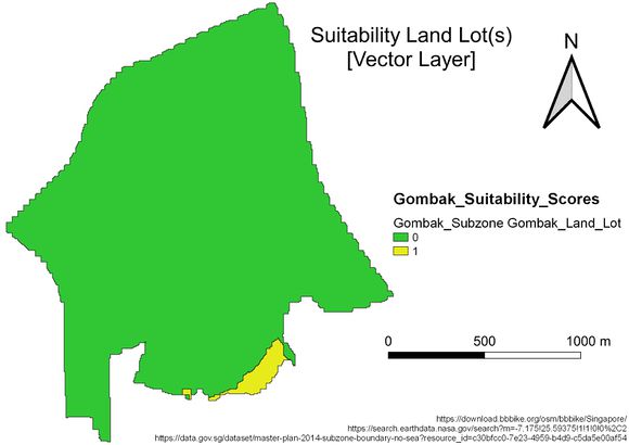
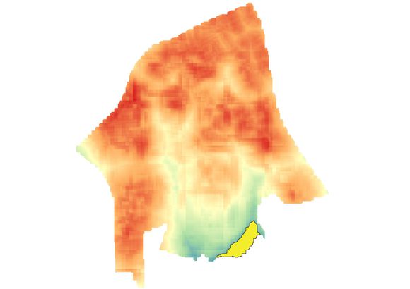
[[File:Suitable Land Lot.jpg|center|580px]] | [[File:Suitable Land Lot.jpg|center|580px]] | ||
| + | |||
| + | |||
| + | |||
| + | |||
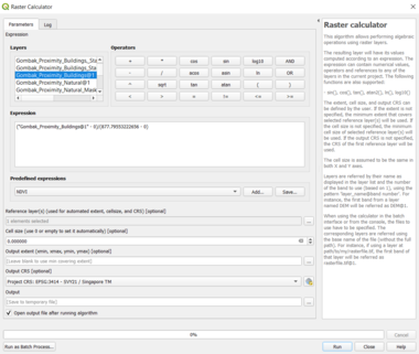
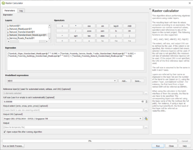
| + | == Computation Methods == | ||
| + | |||
| + | [[File:Standardisation of Buildings.png|center|380px]] | ||
| + | |||
| + | |||
| + | [[File:Standardisation of Total Score Layer.png|center|380px]] | ||
Revision as of 21:20, 8 November 2019
GIS Modelling for Urban Land Suitability Study
Contents
- 1 Target Roads, Buildings, Target Natural Features and Digital Elevation of Study Area (Gombak)
- 2 Proximity to Target Roads, Buildings and Natural Features with Slope Layer of Study Area (Gombak)
- 3 Criterion Scores of each factor layers
- 4 Analytical Hierarchical Process Input Matrix and Result Report
- 5 Suitability Land Lot(s)
- 6 Computation Methods
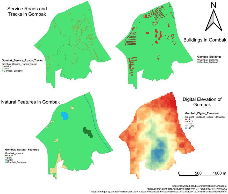
Target Roads, Buildings, Target Natural Features and Digital Elevation of Study Area (Gombak)

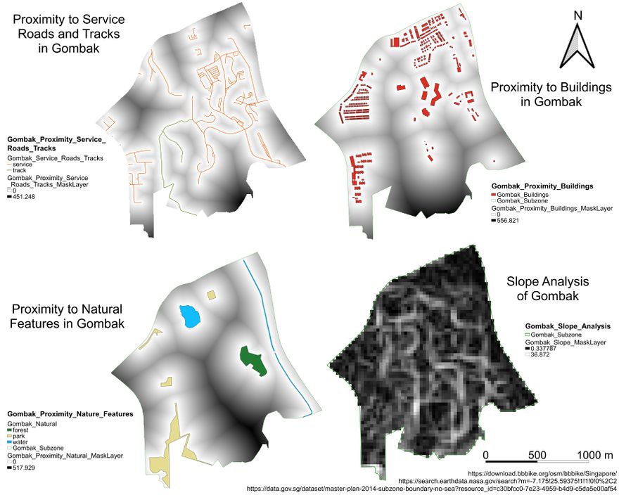
Proximity to Target Roads, Buildings and Natural Features with Slope Layer of Study Area (Gombak)

Criterion Scores of each factor layers

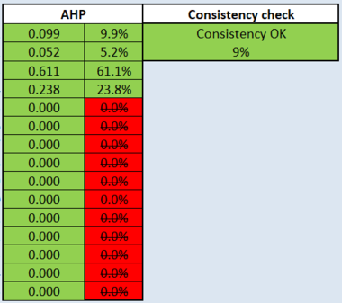
Analytical Hierarchical Process Input Matrix and Result Report
.png)
.png)
Suitability Land Lot(s)


Computation Methods

