Difference between revisions of "File:Possible Chosen Land Lot to Build a National Communicable Disease Quarantine Centre.jpg"
Jump to navigation
Jump to search
(Yunyu.chong.2018 uploaded a new version of File:Possible Chosen Land Lot to Build a National Communicable Disease Quarantine Centre.jpg) |
(Yunyu.chong.2018 uploaded a new version of File:Possible Chosen Land Lot to Build a National Communicable Disease Quarantine Centre.jpg) |
(No difference)
| |
Latest revision as of 10:47, 8 November 2019
Digitised possible land lot that is identified
File history
Click on a date/time to view the file as it appeared at that time.
| Date/Time | Thumbnail | Dimensions | User | Comment | |
|---|---|---|---|---|---|
| current | 10:47, 8 November 2019 | 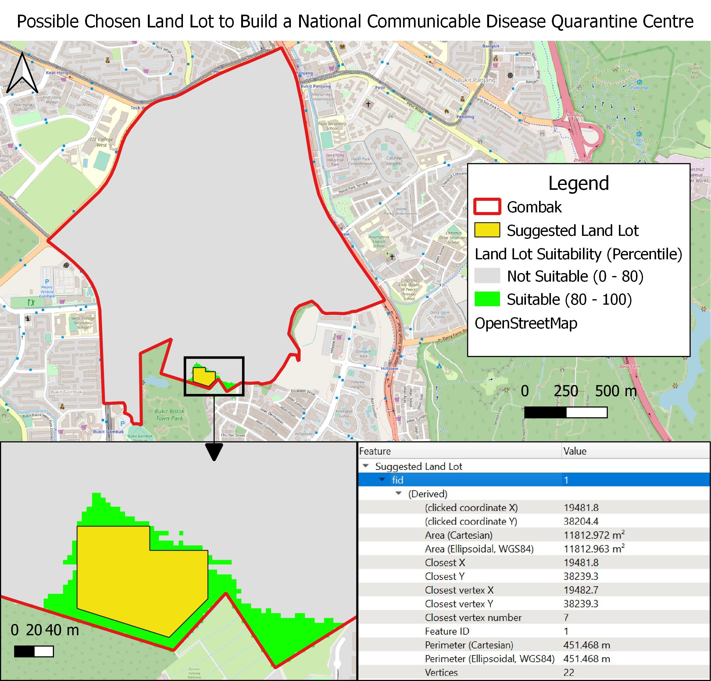 | 2,332 × 2,235 (586 KB) | Yunyu.chong.2018 (talk | contribs) | added arrow |
| 10:46, 8 November 2019 |  | 2,332 × 2,235 (585 KB) | Yunyu.chong.2018 (talk | contribs) | ||
| 14:37, 7 November 2019 |  | 2,073 × 2,167 (521 KB) | Yunyu.chong.2018 (talk | contribs) |
- You cannot overwrite this file.
File usage
The following page links to this file: