Difference between revisions of "SMT201 AY2019-20G2 EX2 Khong Lee Han"
Jump to navigation
Jump to search
Lhkhong.2018 (talk | contribs) |
Lhkhong.2018 (talk | contribs) (→Part 4) |
||
| Line 140: | Line 140: | ||
| − | == Part 4 == | + | == Part 4: Analytical Hierarchical Process Input Matrix & Approach == |
| − | |||
| − | |||
| − | |||
== Part 5 == | == Part 5 == | ||
Revision as of 21:22, 6 November 2019
Contents
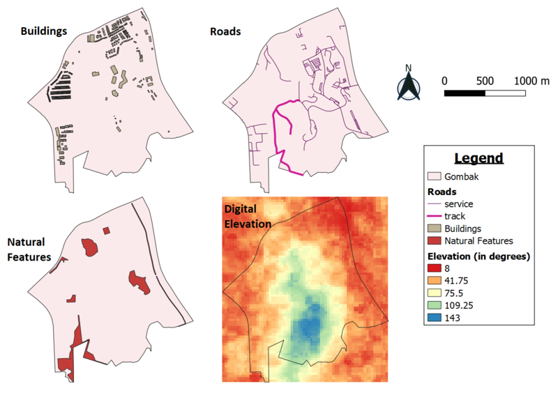
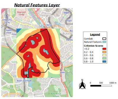
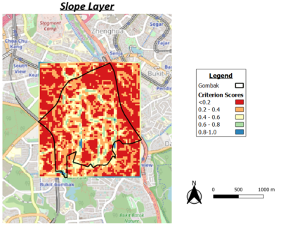
Part 1 : Map View with Study Area and Target Roads, Buildings, Natural Features, Digital Elevations Layer

a short description of not more than 100 words for each view.
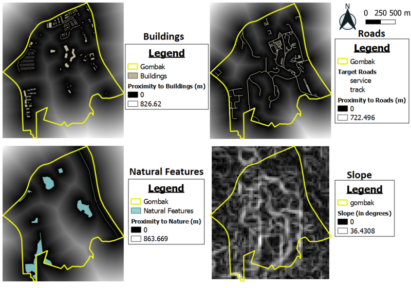
Part 2

a short description of not more than 100 words for each view.
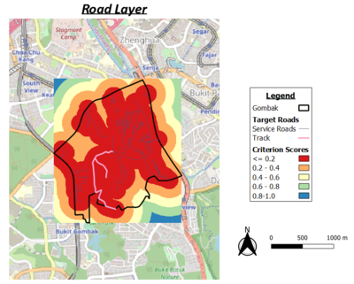
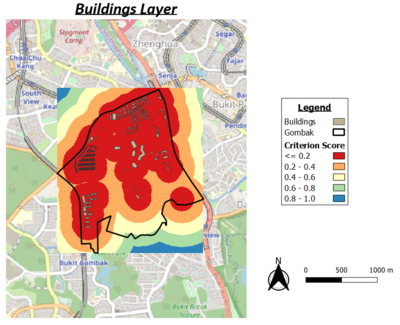
Part 3

abcsdhfdjshf

sfsdgs

fdsfsd

gfdgjfd