Difference between revisions of "File:Proximity Analysis of Roads, Buildings and Natural Features, and Slope Analysis in Gombak.jpg"
Jump to navigation
Jump to search
(Yunyu.chong.2018 uploaded a new version of File:Proximity Analysis of Roads, Buildings and Natural Features, and Slope Analysis in Gombak.jpg) |
(Yunyu.chong.2018 uploaded a new version of File:Proximity Analysis of Roads, Buildings and Natural Features, and Slope Analysis in Gombak.jpg) |
(No difference)
| |
Latest revision as of 21:00, 6 November 2019
Shows the proximity analysis of roads, buildings and natural features, and slopes in Gombak.
File history
Click on a date/time to view the file as it appeared at that time.
| Date/Time | Thumbnail | Dimensions | User | Comment | |
|---|---|---|---|---|---|
| current | 21:00, 6 November 2019 | 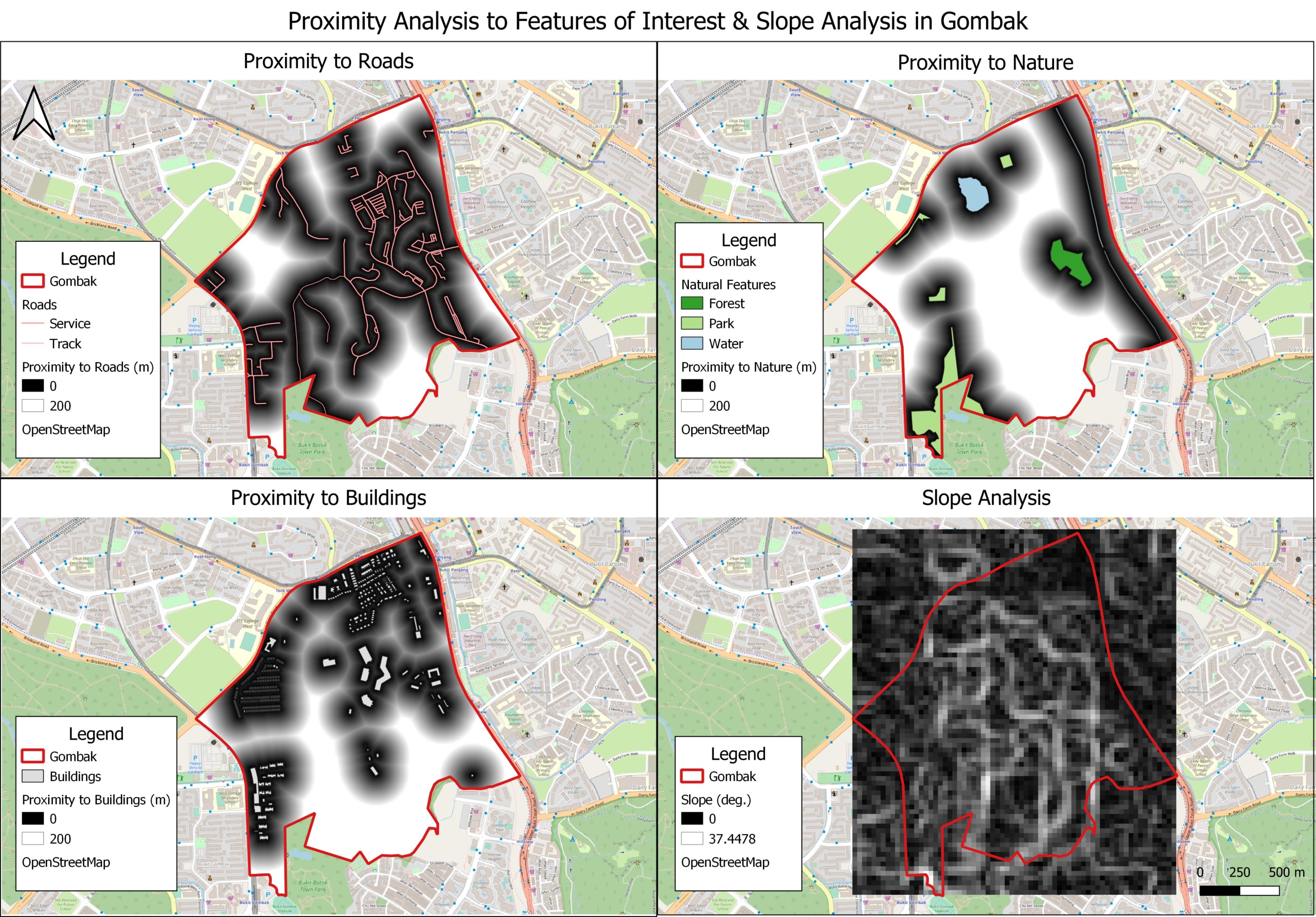 | 3,500 × 2,440 (1.7 MB) | Yunyu.chong.2018 (talk | contribs) | Clipped raster layers to improve aesthetics of map |
| 23:29, 4 November 2019 | Error creating thumbnail: File missing | 5,030 × 3,507 (1.91 MB) | Yunyu.chong.2018 (talk | contribs) | Edited North arrow and scale bar | |
| 18:49, 3 November 2019 | Error creating thumbnail: File missing | 4,716 × 3,264 (1.65 MB) | Yunyu.chong.2018 (talk | contribs) |
- You cannot overwrite this file.
File usage
The following page links to this file: