Difference between revisions of "SMT201 AY2019-20T1 EX2 Heng Bing Chow"
Jump to navigation
Jump to search
Bcheng.2018 (talk | contribs) |
Bcheng.2018 (talk | contribs) |
||
| Line 15: | Line 15: | ||
<br>[Building, Natural and Road] Building, Natural and Road (SHP) from OpenStreetMap.[https://download.bbbike.org/osm/bbbike/Singapore/]. | <br>[Building, Natural and Road] Building, Natural and Road (SHP) from OpenStreetMap.[https://download.bbbike.org/osm/bbbike/Singapore/]. | ||
</small>'' | </small>'' | ||
| + | |||
| + | [[File:Gombak_Study_Area.png|700px|center]] | ||
Revision as of 16:15, 6 November 2019
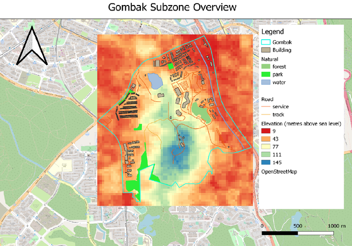
Location for Communicable Disease Quarantine Centre in Gombak
In order to determine a suitable location for building a national Communicable Disease Quarantine Centre, the selected site must 1) be located at Gombak planning subzone , and 2) it must meet the four decision factors:
- Economic factor: The selected site should avoid steep slope to prevent additional development costs such as cut-and-fill of land.
- Accessibility factor: The selected site should be close in proximity to existing local roads, namely: service roads and tracks. This is to ensure easy transportation of building materials during the construction stage.
- Health risk factor: The selected site should be away from population i.e. housing areas and offices in order to avoid disease spreading to the nearby population.
- Natural conservation factor: The selected site should be away from forested land, park and water.
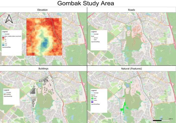
Below is an overview of Gombak's features.

Data Source: [Elevation] ASTER Global Digital Elevation Model (GDEM) dataset (TIFF) jointly prepared by NASA and METI, Japan; raster dataset combined by Professor Kam Tin Seong.[1].
[Gombak] Master Plan 2014 Subzone Boundary (No Sea) (SHP) from URA.[2].
[Building, Natural and Road] Building, Natural and Road (SHP) from OpenStreetMap.[3].
