Difference between revisions of "SMT201 AY2019-20G1 Ex1 Luo Haonan"
Jump to navigation
Jump to search
| Line 11: | Line 11: | ||
== Part2: Choropleth Mapping == | == Part2: Choropleth Mapping == | ||
=== Aged population (+65) in 2010 and 2018 === | === Aged population (+65) in 2010 and 2018 === | ||
| + | {| | ||
| + | |- | ||
| + | | [[File:Part1Q3.png|600px|image]] || [[File:Part1Q3.png|600px|image]] | ||
| + | |} | ||
| + | |||
=== The proportion of the aged population in 2010 and 2018 === | === The proportion of the aged population in 2010 and 2018 === | ||
| + | {| | ||
| + | |- | ||
| + | | [[File:Part1Q3.png|600px|image]] || [[File:Part1Q3.png|600px|image]] | ||
| + | |} | ||
=== The percentage change of aged population between 2010 and 2018 === | === The percentage change of aged population between 2010 and 2018 === | ||
Revision as of 20:34, 15 September 2019
Part1: Thematic Mapping
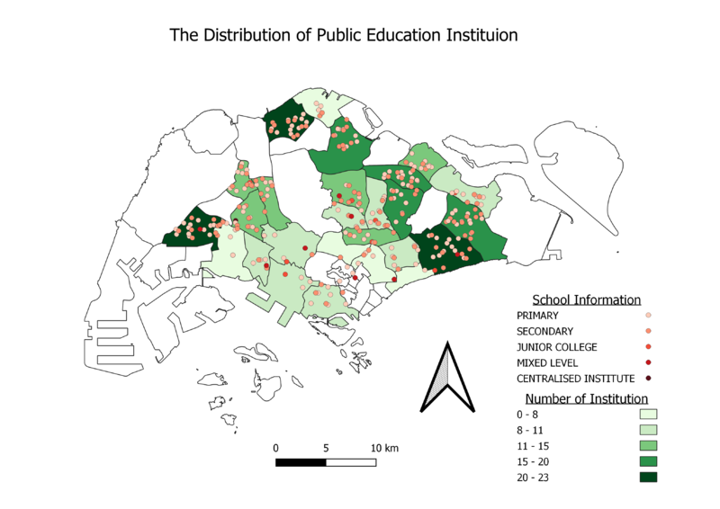
The distribution of public education institution
.png)
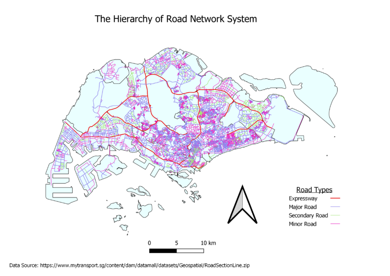
The hierarchy of road network system

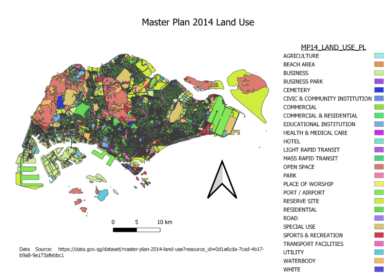
2014 Master Plan Landuse

Part2: Choropleth Mapping
Aged population (+65) in 2010 and 2018
|
|
The proportion of the aged population in 2010 and 2018
|
|