Difference between revisions of "SMT201 AY2019-20G2 Ex1 Soh Bai He"
Jump to navigation
Jump to search
m (Baihe.soh.2018 moved page SMT201 AY2019-20G1 Ex1 Soh Bai He to SMT201 AY2019-20G2 Ex1 Soh Bai He) |
|||
| Line 1: | Line 1: | ||
| + | # Numbered list item | ||
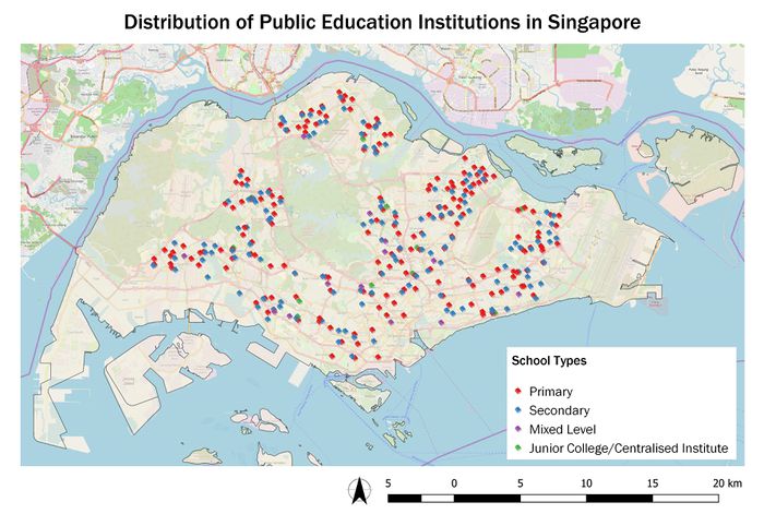
[[File:P1a-schooldistribution.jpg|700px|thumb|center]] | [[File:P1a-schooldistribution.jpg|700px|thumb|center]] | ||
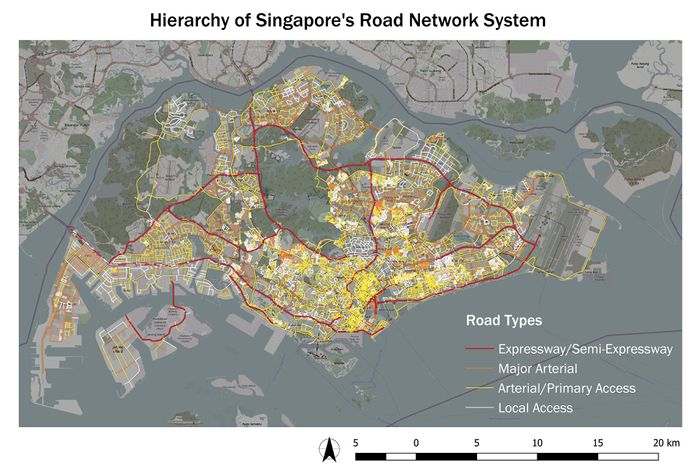
[[File:P1b-roadnetwork.jpg|700px|thumb|center]] | [[File:P1b-roadnetwork.jpg|700px|thumb|center]] | ||
| Line 7: | Line 8: | ||
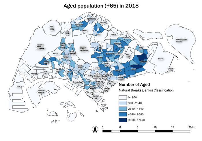
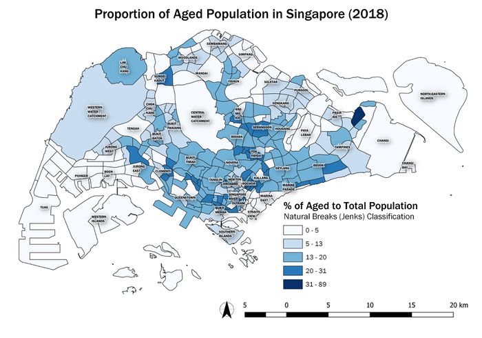
[[File:P2b-2018.jpg|700px|thumb|center]] | [[File:P2b-2018.jpg|700px|thumb|center]] | ||
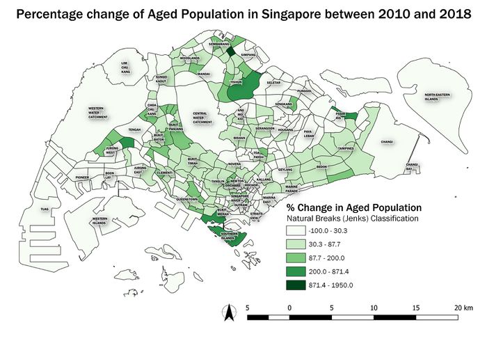
[[File:P2c.jpg|700px|thumb|center]] | [[File:P2c.jpg|700px|thumb|center]] | ||
| + | |||
| + | == Part One == | ||
| + | === Public Education Institutions === | ||
| + | === Road Network System === | ||
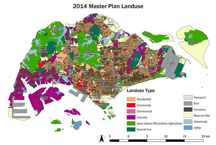
| + | === 2014 Master Plan Landuse === | ||
| + | |||
| + | == Part Two == | ||
Revision as of 14:40, 15 September 2019
- Numbered list item
