Difference between revisions of "SMT201 AY2019-19T1 EX2 Lok Ying Cheng Sheryee"
Jump to navigation
Jump to search
| Line 8: | Line 8: | ||
== Analysis of the features == | == Analysis of the features == | ||
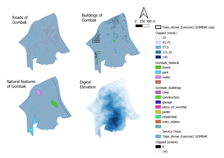
<div class="center" style="width: auto; margin-left: auto; margin-right: auto;">'''Overview of the relevant features in Gombak'''</div> | <div class="center" style="width: auto; margin-left: auto; margin-right: auto;">'''Overview of the relevant features in Gombak'''</div> | ||
| + | |||
| + | [[File:Overview of Gombak sher.png|900px|thumb|center|'''Gombak Study Area with Proximity Map of:<br>- Roads (Top Left)<br>- Buildings (Top Right)<br>- Natural Features (Bottom Left)<br>- Slope (Bottom Right)''']] | ||
| + | |||
<br><br> | <br><br> | ||
<div class="center" style="width: auto; margin-left: auto; margin-right: auto;">'''Proximity Analysis of the features'''</div> | <div class="center" style="width: auto; margin-left: auto; margin-right: auto;">'''Proximity Analysis of the features'''</div> | ||
Revision as of 23:54, 10 November 2019
Objective
To identify a location suitable for building a National Communicable Disease Quarantine Center in Gombak. The selected sit will be with a contiguous area of at least 10,000m2 and it must meet the following decision factors:
1. Economic factor:
The selected site should avoid steep slope. This is because construction at steep slope tends to involve a lot of cut-and-fill and will lend to relatively higher development cost.
Analysis of the features
Overview of the relevant features in Gombak
Proximity Analysis of the features
