Difference between revisions of "SMT201 AY2019-20T1 EX2 Lee Jung Jae"
Jump to navigation
Jump to search
| Line 5: | Line 5: | ||
| − | === | + | === Natural Features === |
| − | === | + | === Buildings === |
| Line 38: | Line 38: | ||
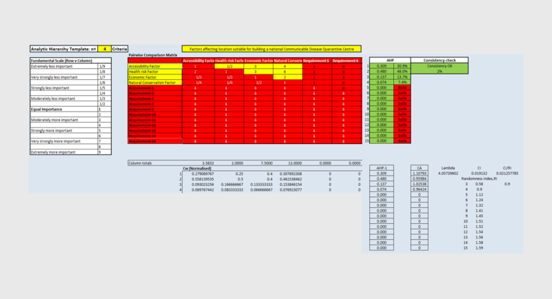
| − | == Part | + | == Part IV: Analytical Hierarchical Process input matrix and result report == |
| − | [[File:AHP | + | [[File:AHP Rankings.png|800px|center]] |
| − | + | ||
| − | + | Descriptionnnnnnnnnnnnnnnn | |
| − | == Part | + | == Part V: A map layout with the suitability land lot(s) == |
| − | [[File: | + | [[File:Part 5 (Suitability).png|800px|center]] |
Revision as of 19:57, 10 November 2019
Contents
- 1 Part I: A map layout with four views showing Gombak (Roads, Natural Features, Buildings and Elevation)
- 2 Part II: A map layout with four views showing Proximity to Gombak Roads, Natural Features, Buildings and Slope
- 3 Part III: A map layout showing the criterion scores of each factor layers
- 4 Part IV: Analytical Hierarchical Process input matrix and result report
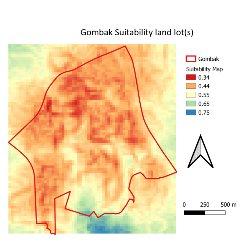
- 5 Part V: A map layout with the suitability land lot(s)
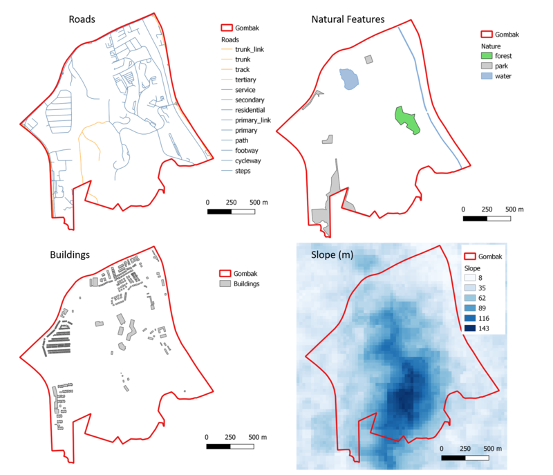
Part I: A map layout with four views showing Gombak (Roads, Natural Features, Buildings and Elevation)

Roads
Natural Features
Buildings
Elevation model
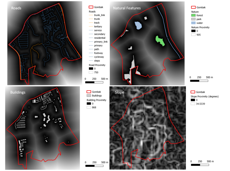
Part II: A map layout with four views showing Proximity to Gombak Roads, Natural Features, Buildings and Slope

Roads Proximity
Natural Features Proximity
Buildings Proximity
Slope Proximity
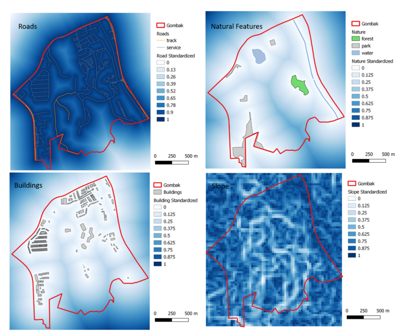
Part III: A map layout showing the criterion scores of each factor layers

Roads Criterion Scores
Natural Features Criterion Score
Buildings Criterion Score
Slope Criterion Score
Part IV: Analytical Hierarchical Process input matrix and result report

Descriptionnnnnnnnnnnnnnnn
Part V: A map layout with the suitability land lot(s)
.png)