Difference between revisions of "Ranked Proximity Map Layout"
Jump to navigation
Jump to search
(Created page with "{{center top}} {| border=1 cellspacing=0 cellpadding=5 | <big>'''Ranked Proximity to target roads'''</big><br> |500px|center |- | <big>''...") |
|||
| Line 2: | Line 2: | ||
{| border=1 cellspacing=0 cellpadding=5 | {| border=1 cellspacing=0 cellpadding=5 | ||
| <big>'''Ranked Proximity to target roads'''</big><br> | | <big>'''Ranked Proximity to target roads'''</big><br> | ||
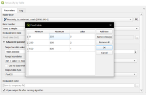
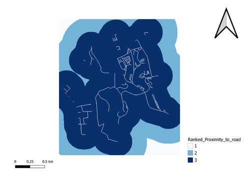
| + | For the accessibility factor, the location needs to be close to existing local roads so we have to reclassify the table and give a higher value for areas near the roads | ||
| + | [[File:rankedproximitytoroad.png|300px|center]] | ||
|[[File:Ranked proximity to road.jpg|500px|center]] | |[[File:Ranked proximity to road.jpg|500px|center]] | ||
|- | |- | ||
Revision as of 14:31, 10 November 2019
| Ranked Proximity to target roads For the accessibility factor, the location needs to be close to existing local roads so we have to reclassify the table and give a higher value for areas near the roads |
|
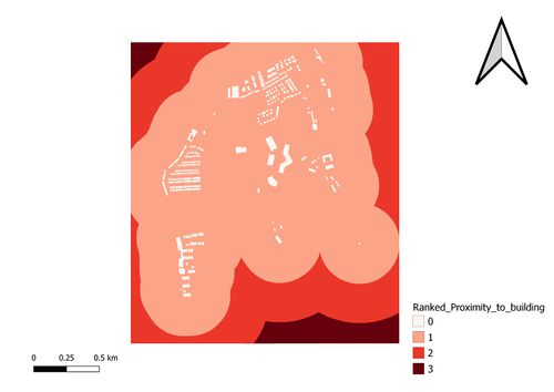
| Ranked Proximity to buildings |
|
| Ranked Proximity to target natural features |
|
| Ranked Proximity to slope |


