Difference between revisions of "SMT201 AY2019-20T1 EX2 Tan Wei Long Ryan"
Jump to navigation
Jump to search
| Line 10: | Line 10: | ||
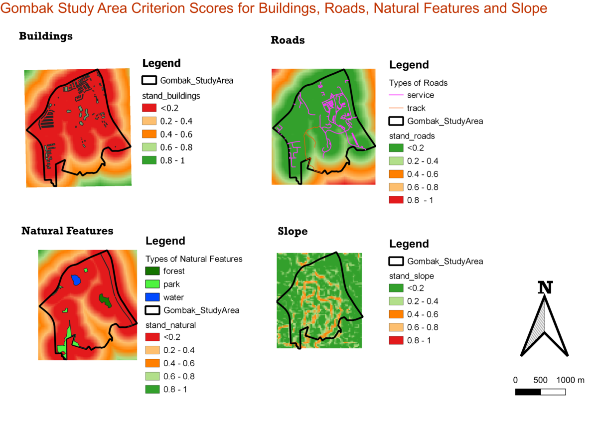
== Part Three: Criterion Score of Factor Layers == | == Part Three: Criterion Score of Factor Layers == | ||
| + | [[File:AS2 Part3.png|1200px|thumb|center]] | ||
== Part Four: Analytical Hierarchical Process Input Matrix & Result Report == | == Part Four: Analytical Hierarchical Process Input Matrix & Result Report == | ||
Revision as of 00:59, 10 November 2019
Contents
- 1 Part One : Map View with Study Area and Target Roads, Buildings, Natural Features, Digital Elevations Layer
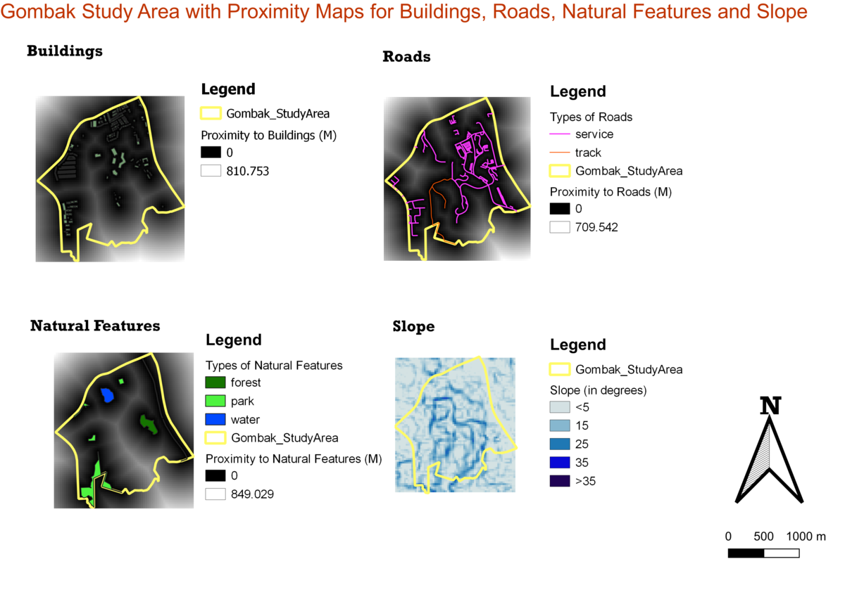
- 2 Part Two: Proximity Map Layers
- 3 Part Three: Criterion Score of Factor Layers
- 4 Part Four: Analytical Hierarchical Process Input Matrix & Result Report
- 5 Part Five: Suitability Land Lot
- 6 References and data sources
Part One : Map View with Study Area and Target Roads, Buildings, Natural Features, Digital Elevations Layer
Buildings
Roads
Natural Features
Elevation


