Difference between revisions of "SMT201 AY2019-20T1 EX2 Zang Yu"
Jump to navigation
Jump to search
Yu.zang.2016 (talk | contribs) |
Yu.zang.2016 (talk | contribs) |
||
| Line 1: | Line 1: | ||
== Study Area == | == Study Area == | ||
| − | === A map | + | === A map with four factors=== |
* the study area and the target roads, | * the study area and the target roads, | ||
* the study area and buildings, | * the study area and buildings, | ||
| Line 10: | Line 10: | ||
== Proximity analysis == | == Proximity analysis == | ||
| + | === A map with four factors=== | ||
* the study area and proximity to target roads layer, | * the study area and proximity to target roads layer, | ||
* the study area and proximity to buildings layer, | * the study area and proximity to buildings layer, | ||
Revision as of 20:25, 9 November 2019
Contents
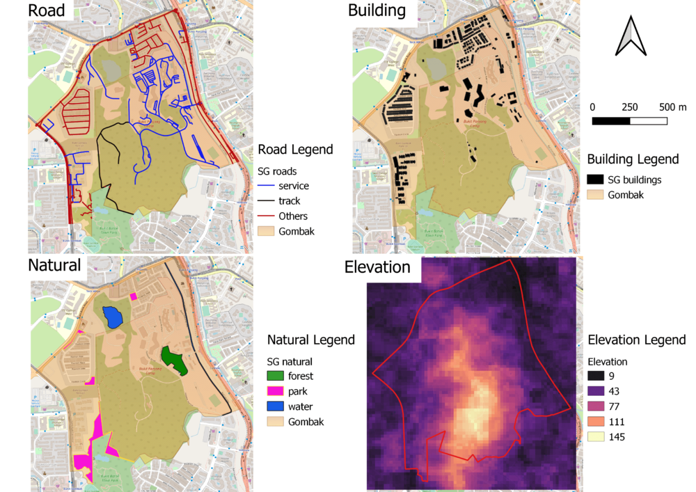
Study Area
A map with four factors
- the study area and the target roads,
- the study area and buildings,
- the study area and the target natural features,
- the study area and digital elevation

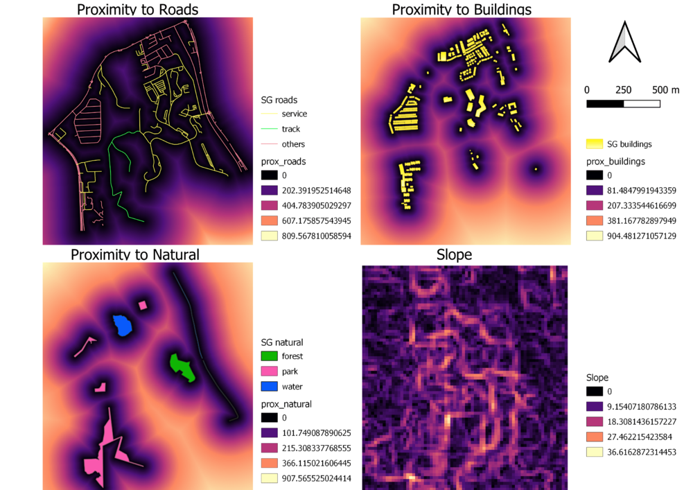
Proximity analysis
A map with four factors
- the study area and proximity to target roads layer,
- the study area and proximity to buildings layer,
- the study area and proximity to target natural features layer,
- the study area and slope layer
