Difference between revisions of "File:RoadNetworkSystem.png"
Jump to navigation
Jump to search
(Melanie.tan.2018 uploaded a new version of File:RoadNetworkSystem.png) |
(Melanie.tan.2018 uploaded a new version of File:RoadNetworkSystem.png) |
(No difference)
| |
Latest revision as of 19:37, 14 September 2019
I have decided to put the major road with the thickest line and the slip roads with thinner lines, this is with the intention to differentiate the roads. Expressway is a neon colour to stand out from all the roads. International and contour lines are then represented with colours that are less obvious as compared to the other roads.
File history
Click on a date/time to view the file as it appeared at that time.
| Date/Time | Thumbnail | Dimensions | User | Comment | |
|---|---|---|---|---|---|
| current | 19:37, 14 September 2019 | 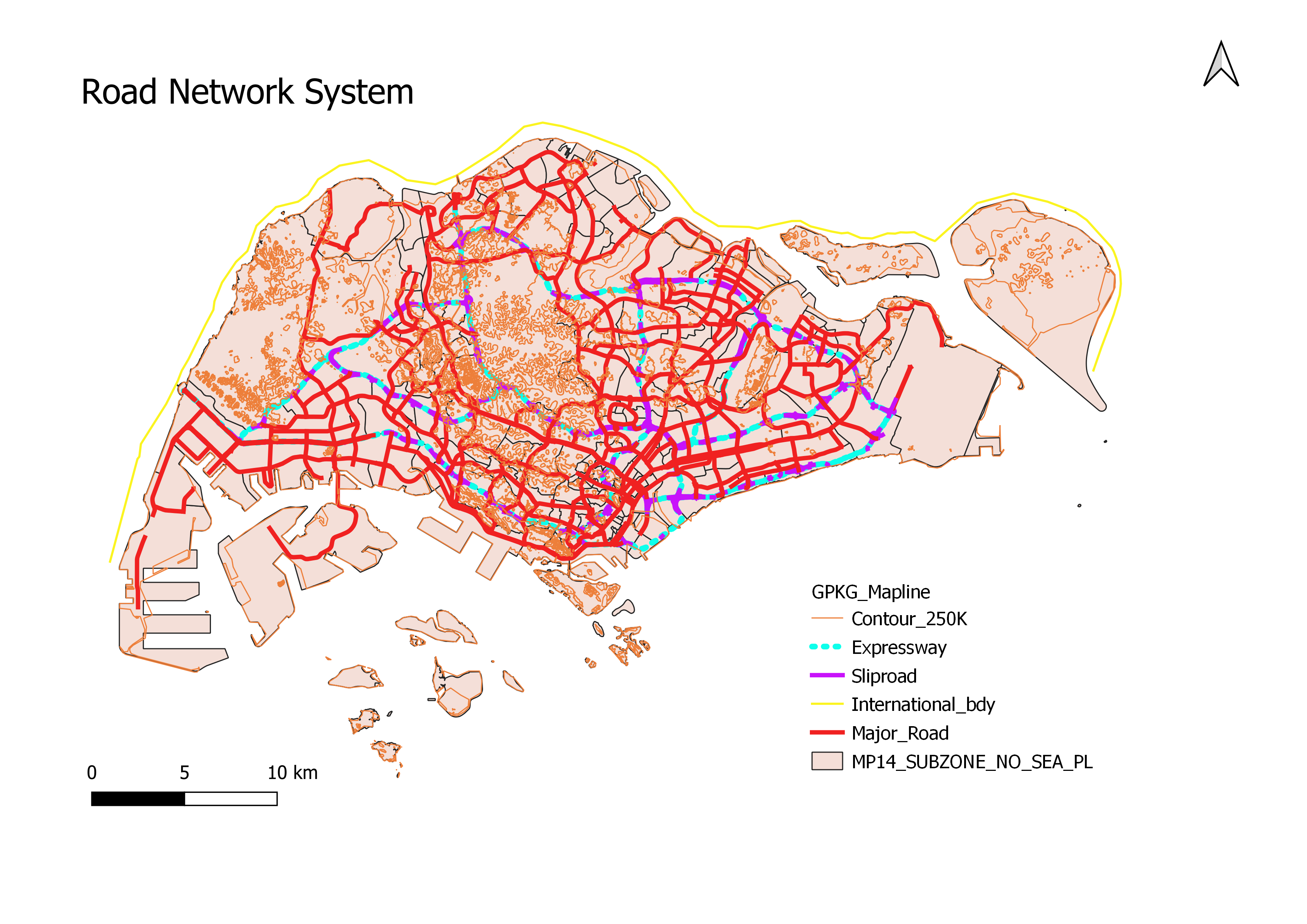 | 3,507 × 2,480 (1.61 MB) | Melanie.tan.2018 (talk | contribs) | Reverted to version as of 18:55, 14 September 2019 (+08) |
| 19:37, 14 September 2019 | 987 × 390 (13 KB) | Melanie.tan.2018 (talk | contribs) | |||
| 18:55, 14 September 2019 |  | 3,507 × 2,480 (1.61 MB) | Melanie.tan.2018 (talk | contribs) |
- You cannot overwrite this file.
File usage
There are no pages that use this file.