Difference between revisions of "SMT201 AY2019-20G2 EX2 Khong Lee Han"
Lhkhong.2018 (talk | contribs) |
Lhkhong.2018 (talk | contribs) |
||
| Line 28: | Line 28: | ||
| − | a | + | '''Buildings:''' To build a disease centre, it needs to be far away from the population to prevent spreading of diseases to the nearby population. The data was extracted from BBBike@Singapore. |
| − | |||
| + | '''Target Roads:''' To build a disease centre, it needs to be close to existing local roads, namely: service roads and tracks to ensure easy transportation of building materials during the construction stage. The data was extracted from BBBike@Singapore. | ||
| + | '''Natural Conservation:''' The selected site needs to be away from forested land, park and water as when the disease enter the water bodies of Singapore. The data was extracted from BBBike@Singapore. | ||
| + | '''Elevation:''' The selected site needs to avoid slope as this will incur large construction cost as steep slopes involves a lot of cut-and-fills and leads to relatively higher development costs. The data was extracted from NASA's EarthData Search Site and was prepared by importing the raster data into QGIS. | ||
== Part 2 == | == Part 2 == | ||
Revision as of 11:30, 7 November 2019
Contents
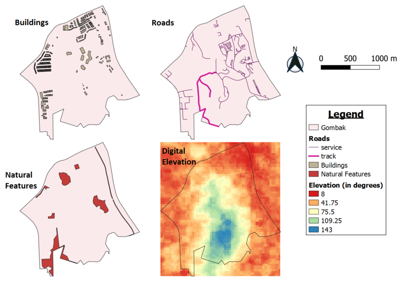
Part 1 : Map View with Study Area and Target Roads, Buildings, Natural Features, Digital Elevations Layer
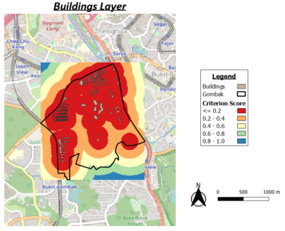
Buildings: To build a disease centre, it needs to be far away from the population to prevent spreading of diseases to the nearby population. The data was extracted from BBBike@Singapore.
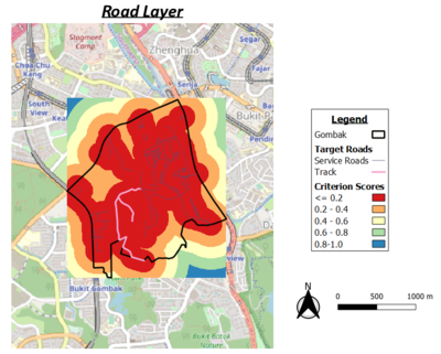
Target Roads: To build a disease centre, it needs to be close to existing local roads, namely: service roads and tracks to ensure easy transportation of building materials during the construction stage. The data was extracted from BBBike@Singapore.
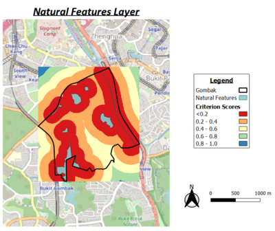
Natural Conservation: The selected site needs to be away from forested land, park and water as when the disease enter the water bodies of Singapore. The data was extracted from BBBike@Singapore.
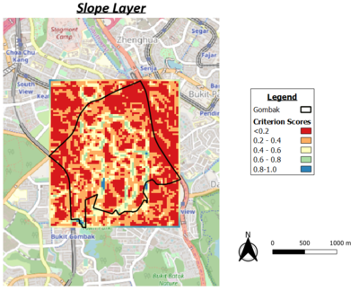
Elevation: The selected site needs to avoid slope as this will incur large construction cost as steep slopes involves a lot of cut-and-fills and leads to relatively higher development costs. The data was extracted from NASA's EarthData Search Site and was prepared by importing the raster data into QGIS.
Part 2
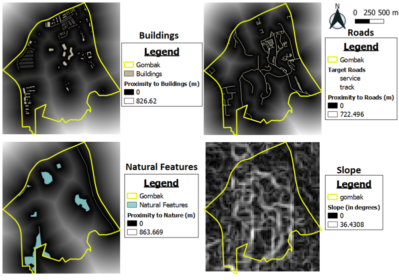
a short description of not more than 100 words for each view.
Part 3
abcsdhfdjshf
sfsdgs
fdsfsd
gfdgjfd
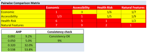
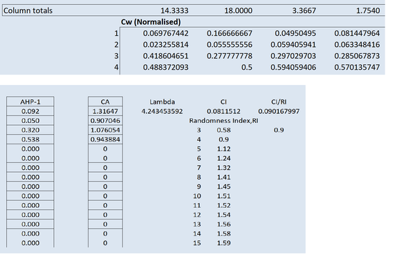
Part 4: Analytical Hierarchical Process Input Matrix & Approach
