Difference between revisions of "SMT201 AY2019-20T1 EX2 Tan Zi Ying"
Jump to navigation
Jump to search
Zy.tan.2018 (talk | contribs) |
Zy.tan.2018 (talk | contribs) |
||
| Line 20: | Line 20: | ||
<br/> | <br/> | ||
<br/> | <br/> | ||
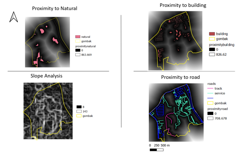
| − | [[ File: | + | [[ File:proximity3.png|800px|center|Proximity Analysis]] |
source: Master Plan 2014 Subzone Boundary from URA from data.gov.sg. | source: Master Plan 2014 Subzone Boundary from URA from data.gov.sg. | ||
Roads, buildings and natural features data from OpenStreetMap (OSM) data sets from BBBike@Singapore. | Roads, buildings and natural features data from OpenStreetMap (OSM) data sets from BBBike@Singapore. | ||
Revision as of 02:27, 7 November 2019
Contents
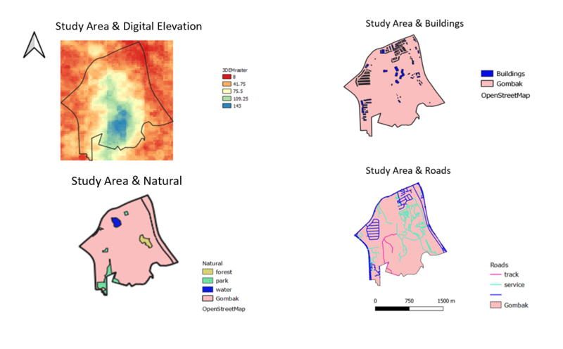
Building a national Communicable Disease Quarantine Centre
- Economic Factor (study area and digital elevation)
- Accessibility Factor (study area and target roads)
- Health Risk Factor (study area and buildings)
- Natural Conservation Factor (study area and natural)

source: Master Plan 2014 Subzone Boundary from URA from data.gov.sg. Roads, buildings and natural features data from OpenStreetMap (OSM) data sets from BBBike@Singapore. ASTER Global Digital Elevation Model (GDEM) dataset jointly prepared by NASA and METI, Japan from NASA’s EarthData Search site complied by Professor Kam
Proximity Analysis
- the study area and proximity to target roads layer
- the study area and proximity to buildings layer
- the study area and proximity to target natural features layer
- the study area and slope layer

source: Master Plan 2014 Subzone Boundary from URA from data.gov.sg. Roads, buildings and natural features data from OpenStreetMap (OSM) data sets from BBBike@Singapore. ASTER Global Digital Elevation Model (GDEM) dataset jointly prepared by NASA and METI, Japan from NASA’s EarthData Search site complied by Professor Kam