Difference between revisions of "SMT201 AY2019-20G1 EX2 Sabrina Liau Ying Ying"
Jump to navigation
Jump to search

| Line 1: | Line 1: | ||
| + | == Objectives == | ||
| + | Build a National Communicate Disease Quarantine Centre | ||
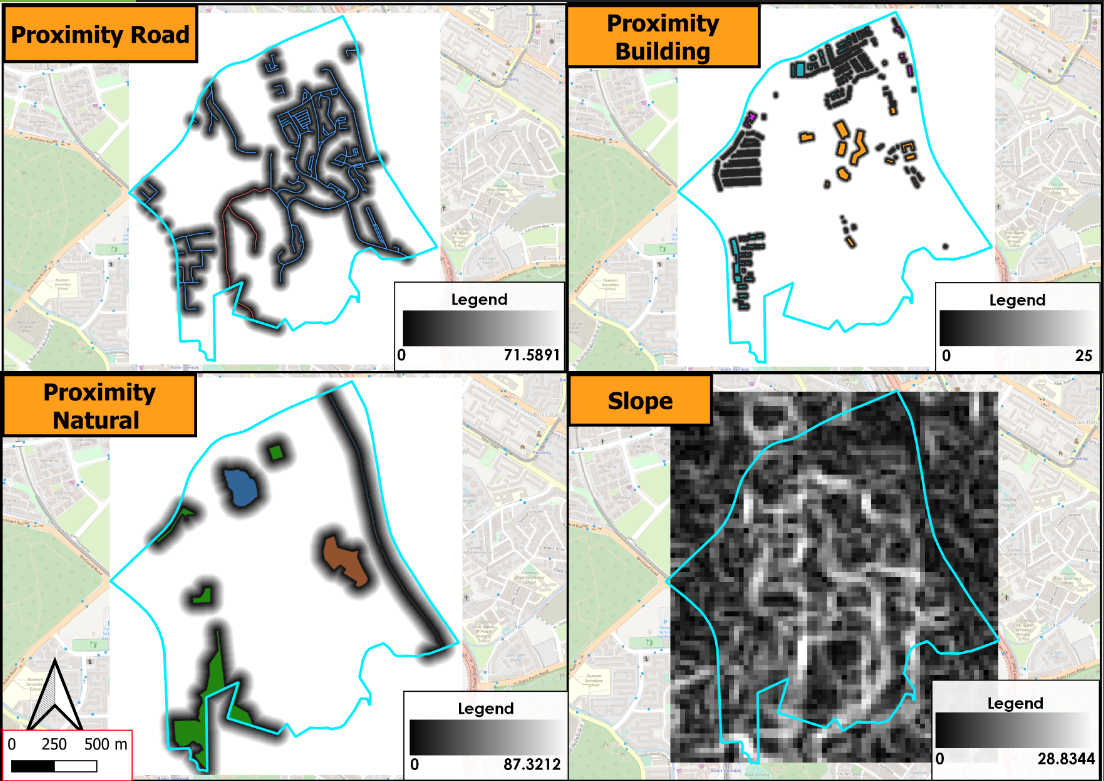
| + | 1) Economic factor: Avoid steep slope. To reduce cut-and-fill and High development costs. | ||
| + | 2) Accessibility factor: Close to existing local roads: service roads and tracks. To ensure easy transportation of building materials during the construction stage. | ||
| + | 3) Health risk factor: Away from population: housing areas and offices. To avoid disease spreading to the nearby population. | ||
| + | 4) Natural conservation factor: Away from forested land, park, and water. | ||
| + | |||
| + | |||
== Map Layout: Study Area == | == Map Layout: Study Area == | ||
<br> [[File:Sab clip.png|1200px|frameless|center]] <br> | <br> [[File:Sab clip.png|1200px|frameless|center]] <br> | ||
Revision as of 12:17, 7 November 2019
Contents
Objectives
Build a National Communicate Disease Quarantine Centre 1) Economic factor: Avoid steep slope. To reduce cut-and-fill and High development costs. 2) Accessibility factor: Close to existing local roads: service roads and tracks. To ensure easy transportation of building materials during the construction stage. 3) Health risk factor: Away from population: housing areas and offices. To avoid disease spreading to the nearby population. 4) Natural conservation factor: Away from forested land, park, and water.
Map Layout: Study Area

Map Layout: Proximity & Slope layers with the Study area

Criterion Scores
Analytical Hierarchical Process
Input matrix
Result report