Difference between revisions of "SMT201 AY2018-19T1 EX2 Soh Ze Yu"
(Created page with " == Map layout == === 4 view layout of study area with: === [[File: |1000x1000px|center|]] the study area and the target roads, • the study area and buildings, • the stu...") |
|||
| Line 3: | Line 3: | ||
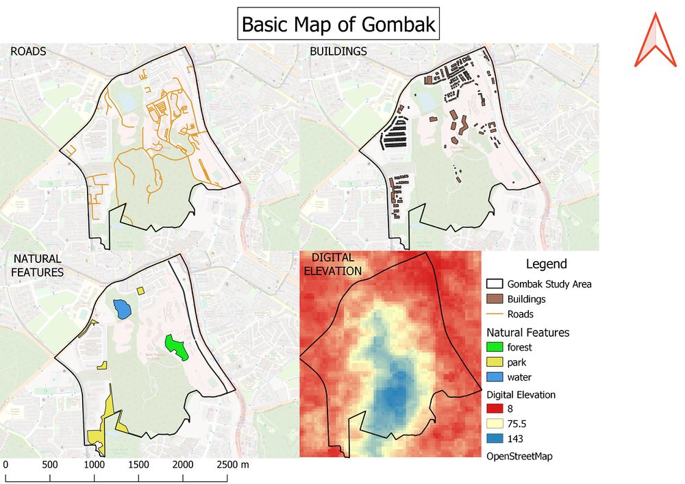
=== 4 view layout of study area with: === | === 4 view layout of study area with: === | ||
| − | [[File: |1000x1000px|center|]] | + | [[File:4_Maps_1.jpeg|1000x1000px|center|]] |
| + | |||
| + | |||
the study area and the target roads, | the study area and the target roads, | ||
| Line 14: | Line 16: | ||
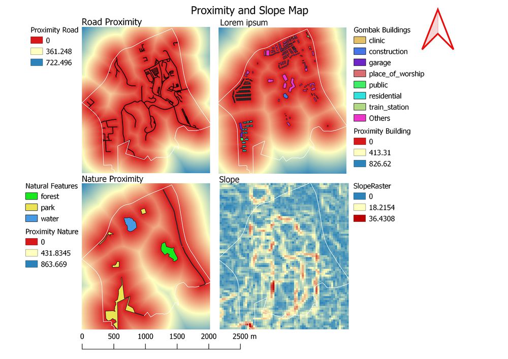
=== A map layout with four views of proximity and slope: === | === A map layout with four views of proximity and slope: === | ||
| + | [[File:3Prox 1slope.jpeg|1000x1000px|center|]] | ||
• the study area and proximity to target roads layer, | • the study area and proximity to target roads layer, | ||
| Line 26: | Line 29: | ||
• An Analytical Hierarchical Process input matrix and result report and a short description of not more than 150 words discussing the analysis results. | • An Analytical Hierarchical Process input matrix and result report and a short description of not more than 150 words discussing the analysis results. | ||
• A map layout with the suitability land lot(s) and a short description of not more than 200 words commenting on each of the suitable land lot identified. | • A map layout with the suitability land lot(s) and a short description of not more than 200 words commenting on each of the suitable land lot identified. | ||
| + | |||
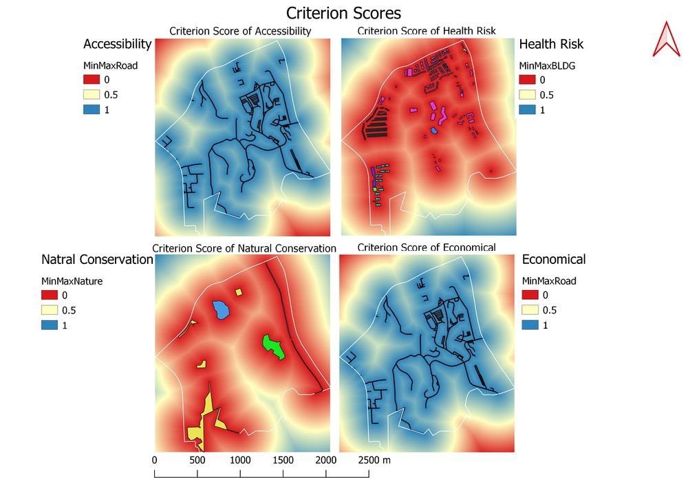
| + | [[File:4MapCriterionfinal.jpeg|1000x1000px|center|]] | ||
Revision as of 22:02, 10 November 2019
Contents
Map layout
4 view layout of study area with:
the study area and the target roads, • the study area and buildings, • the study area and the target natural features, • the study area and digital elevation
<100 words each pic:
A map layout with four views of proximity and slope:
• the study area and proximity to target roads layer, • the study area and proximity to buildings layer, • the study area and proximity to target natural features layer, • the study area and slope layer, and <150 words for each view.
4 views of factor layer scores
• A map layout with four views showing the criterion scores of each factor layers <150 words for each view. • An Analytical Hierarchical Process input matrix and result report and a short description of not more than 150 words discussing the analysis results. • A map layout with the suitability land lot(s) and a short description of not more than 200 words commenting on each of the suitable land lot identified.


