Difference between revisions of "SMT201 AY2019-20G2 Ex1 Mabelle Tham Shiqin"
Jump to navigation
Jump to search
| Line 3: | Line 3: | ||
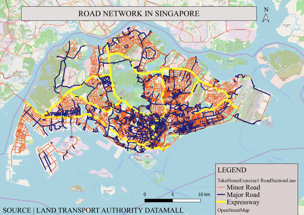
=== Figure 1: Road Network System of Singapore === | === Figure 1: Road Network System of Singapore === | ||
| − | [[File:Road Network in Singapore.png| | + | [[File:Road Network in Singapore.png|center|1000px|Figure 1: Road Network in Singapore]] |
==== Description ==== | ==== Description ==== | ||
Revision as of 01:37, 16 September 2019
Contents
Part One: Thematic Mapping
Figure 1: Road Network System of Singapore

Description
Data sourced from LTA did not have distinctly categorized road types, hence I used QGIS to categorize the roads by Road Type – categorizing them into Expressways, Major Roads and Minor Roads segregating them by colour and thickness.
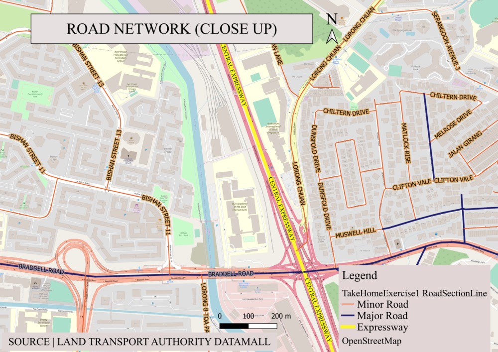
Figure 2: Road Network (Close Up)
.png)
Description
For this map, I chose contrasting, distinct, bright colours for the roads as seen from the 1cm thick bright yellow for Expressway, 0.5cm thick dark blue for Major Road and 0.25cm thin bright orange line for minor roads. For enhanced and clearer visualization, I applied the buffer for each label, ensuring that road names will be easy to read.