Difference between revisions of "SMT201 AY2018-19T1 EX1 Nigel Poon Wei Chun"
Jump to navigation
Jump to search

| Line 7: | Line 7: | ||
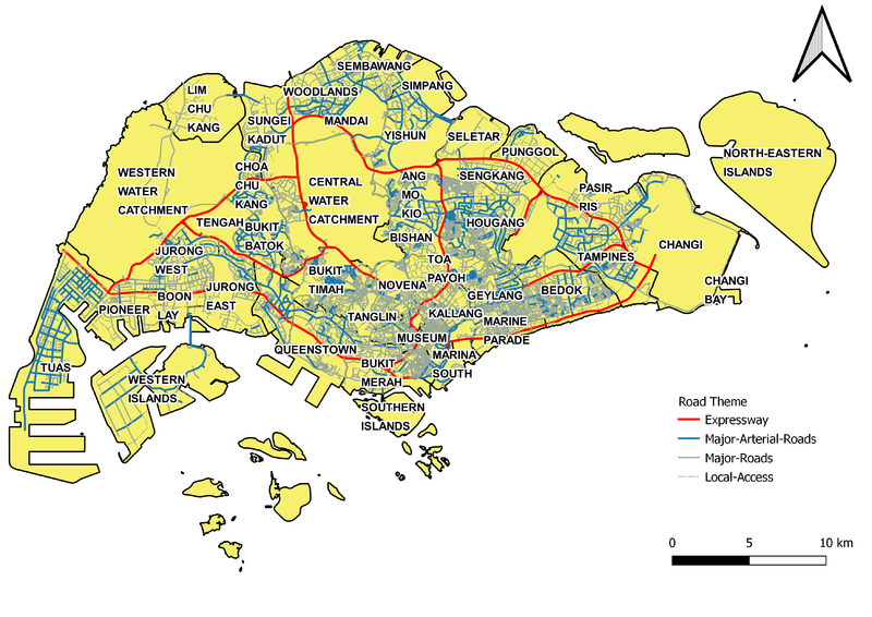
[[File:NigelRoadTheme.png|800px|center]] | [[File:NigelRoadTheme.png|800px|center]] | ||
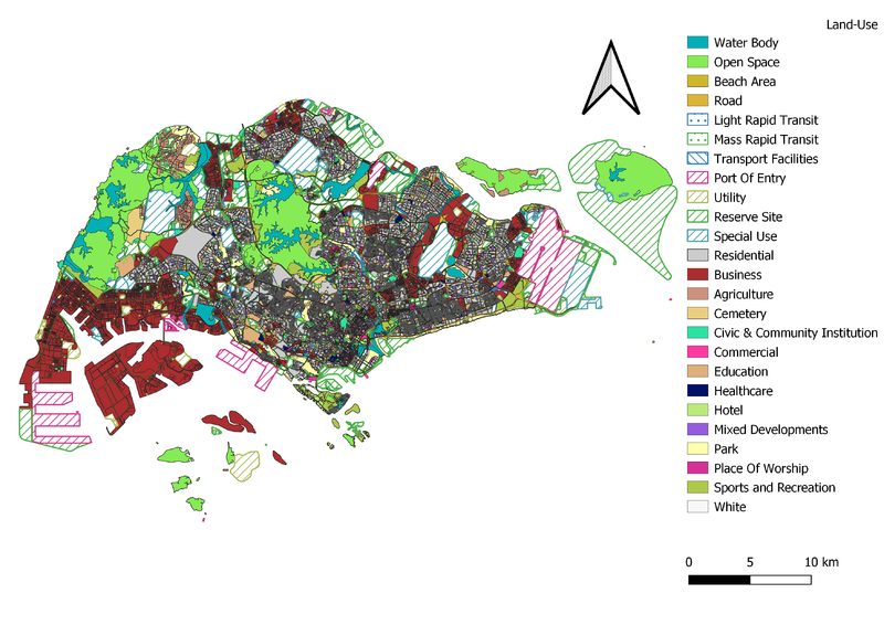
=== Master Plan Land use === | === Master Plan Land use === | ||
| − | + | [[File:NigelLandUse.png|800px|center]] | |
== Choropleth Mapping == | == Choropleth Mapping == | ||
| Line 13: | Line 13: | ||
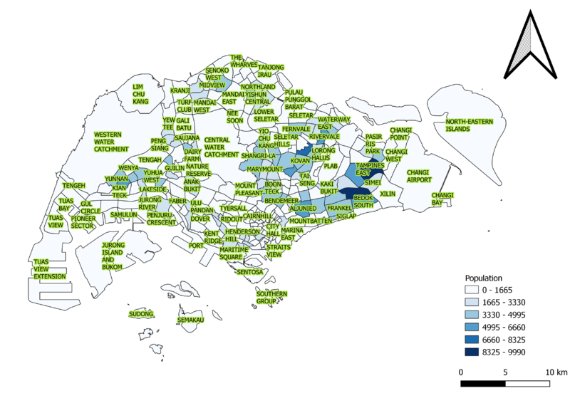
=== Population Aged 65+ === | === Population Aged 65+ === | ||
| − | + | [[File:NigelAgedPopulation2018.png|800px|center]] | |
=== Proportion Aged 65+ === | === Proportion Aged 65+ === | ||
| Line 19: | Line 19: | ||
=== Percentage Change between 2010 and 2018 === | === Percentage Change between 2010 and 2018 === | ||
| + | [[File:NigelAgedPopulationChange.png|800px|center]] | ||
Revision as of 21:08, 15 September 2019
Contents
Thematic Mapping
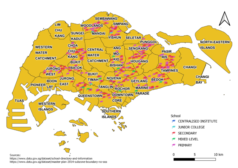
Level of Schools

Road Hierarchy Map

Master Plan Land use

Choropleth Mapping
Population Aged 65+

Proportion Aged 65+
Percentage Change between 2010 and 2018
