Difference between revisions of "SMT201 AY2019-20T1 EX1 Sabrina Liau Ying Ying"
Jump to navigation
Jump to search

| Line 5: | Line 5: | ||
=== Singapore's Road Section Line === | === Singapore's Road Section Line === | ||
| − | [[File:RoadSection Map|700px|frameless|center|]] | + | [[File:RoadSection Map.png|700px|frameless|center|]] |
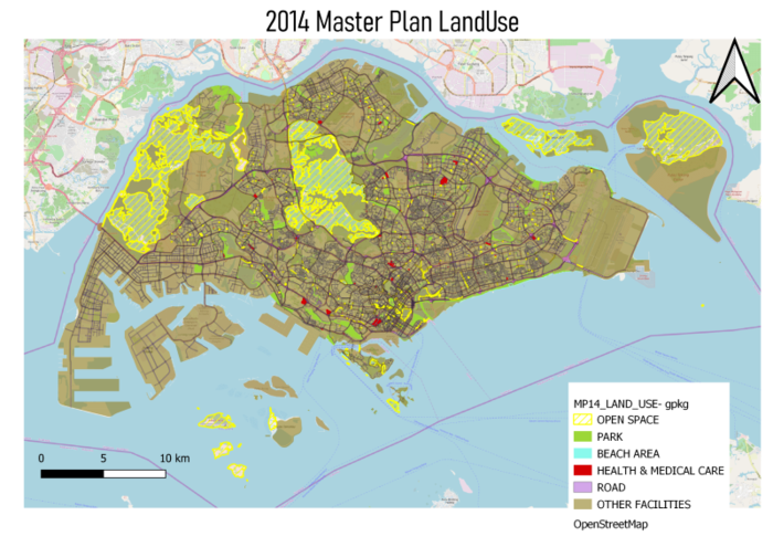
=== 2014 Master Plan Landuse === | === 2014 Master Plan Landuse === | ||
| − | [[File:MP_14_Land|700px|frameless|center|]] | + | [[File:MP_14_Land.png|700px|frameless|center|]] |
| + | |||
=== File Structure for Part One === | === File Structure for Part One === | ||
Revision as of 20:42, 15 September 2019
Contents
Part One
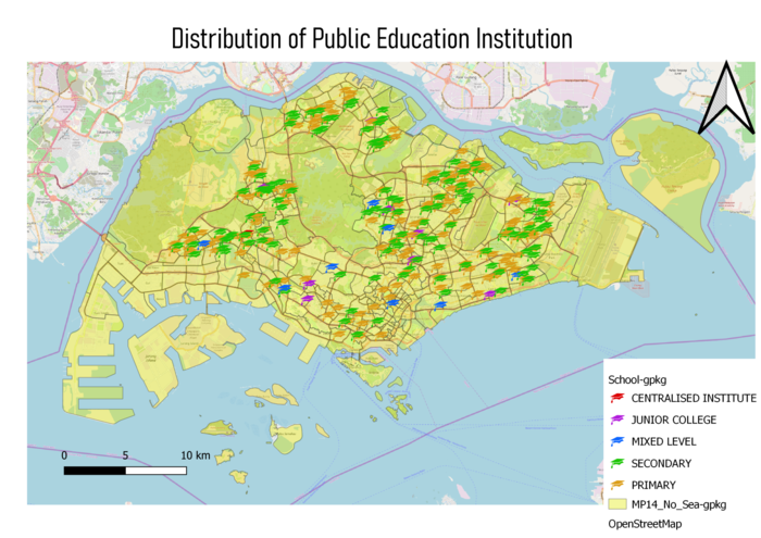
Public Education Institution Distribution in Singapore

Singapore's Road Section Line

2014 Master Plan Landuse
