Difference between revisions of "G1-Group09 Web Maps"
Jump to navigation
Jump to search


Figure 1. Land suitability for construction of a library in Punggol for the young (Age 0 to 4)
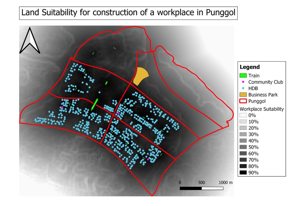
Figure 2. Land suitability for construction of a workspace in Punggol for the Economically Active (Age 15 to 64)

Figure 3. Land suitability for construction of Elderlycare in Punggol for the elderly(Age 65 and above)
| Line 1: | Line 1: | ||
| + | [[File:G1-Group09.logo.png|center|500px|]] | ||
| + | |||
<center> | <center> | ||
{| style="background-color:#7FCBEB ;margin:0px 0px 0px 0px;width="100%" | | {| style="background-color:#7FCBEB ;margin:0px 0px 0px 0px;width="100%" | | ||
| Line 19: | Line 21: | ||
== Link to Webmap == | == Link to Webmap == | ||
| + | |||
'''Click on the figures to view the respective webmap.''' | '''Click on the figures to view the respective webmap.''' | ||
Revision as of 18:23, 23 November 2019
Link to Webmap
Click on the figures to view the respective webmap.