Difference between revisions of "SMT201 AY2019-20T1 EX2 Soh Bai He"
| Line 1: | Line 1: | ||
== Objective == | == Objective == | ||
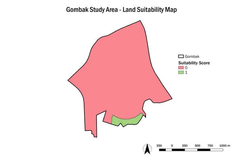
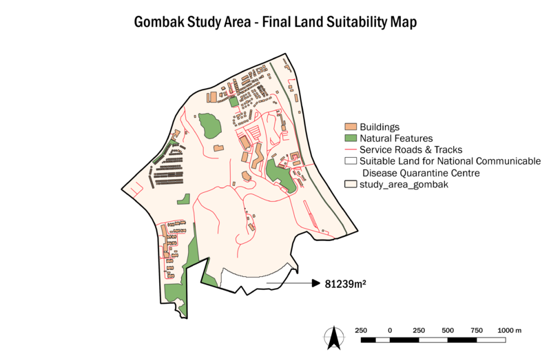
| − | To identify a location in Gombak planning subzone that is suitable for building a | + | To identify a location in Gombak planning subzone that is suitable for building a '''National Communicable Disease Quarantine Centre''', the following decision factors are studied in this report:<br> |
| − | 1. Accessibility Factor: The selected site should be close to existing service roads and tracks, to ensure the ease of transportation of resources during the construction of the Centre.<br> | + | 1. '''Accessibility Factor:''' The selected site should be close to existing service roads and tracks, to ensure the ease of transportation of resources during the construction of the Centre.<br> |
| − | 2. Health Risk Factor: The selected site should be away from the population in order to avoid the spread of the disease.<br> | + | 2. '''Health Risk Factor:''' The selected site should be away from the population in order to avoid the spread of the disease.<br> |
| − | 3. Natural Conservation Factor: The selected site should be away from forested land, park and water. <br> | + | 3. '''Natural Conservation Factor:''' The selected site should be away from forested land, park and water. <br> |
| − | 4. Economic Factor: The selected site should avoid steep slope to as it involves a lot of cut-and-fill which would lead to relatively higher development cost.<br><br> | + | 4. '''Economic Factor:''' The selected site should avoid steep slope to as it involves a lot of cut-and-fill which would lead to relatively higher development cost.<br><br> |
| + | |||
| + | == Data Source == | ||
| + | {| class="wikitable" | ||
| + | |- | ||
| + | ! Name !! Format !! Source | ||
| + | |- | ||
| + | | Master Plan 2014 Subzone Boundary (No Sea) || SHP || [https://data.gov.sg/dataset/master-plan-2014-subzone-boundary-no-sea data.gov] | ||
| + | |- | ||
| + | | Roads, Buildings, Natural || SHP || [https://download.bbbike.org/osm/bbbike/Singapore/ OpenStreetMap] | ||
| + | |- | ||
| + | | ASTER DEM || Raster || x | ||
| + | |} | ||
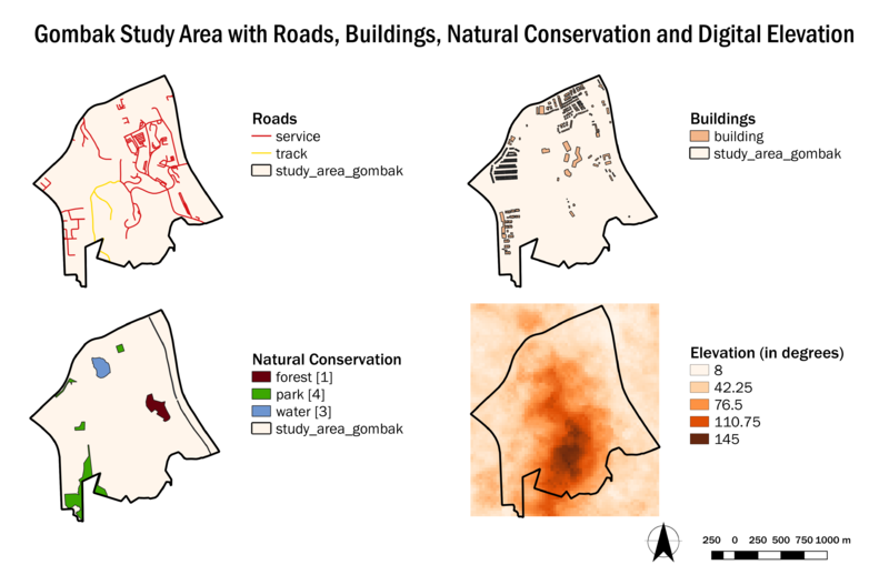
== Gombak Study Area with Features of Interest == | == Gombak Study Area with Features of Interest == | ||
Revision as of 23:00, 10 November 2019
Objective
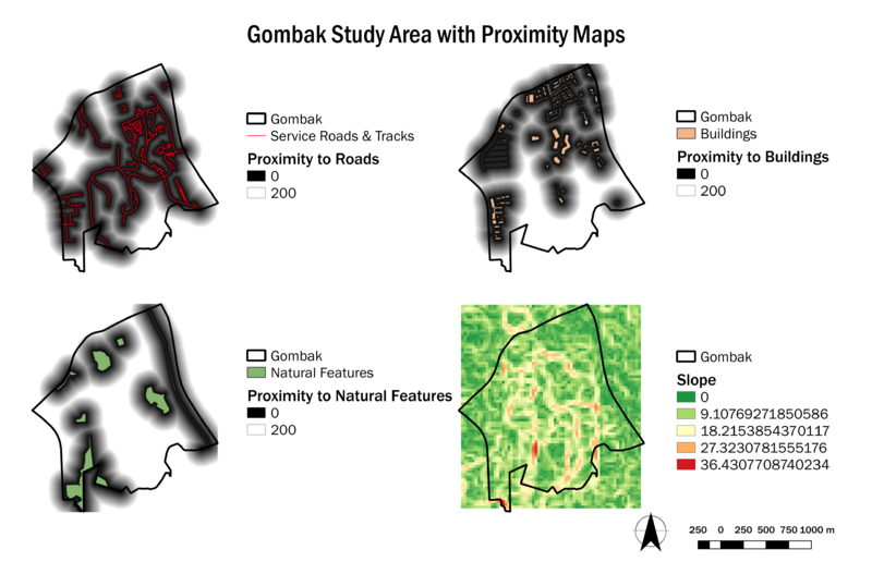
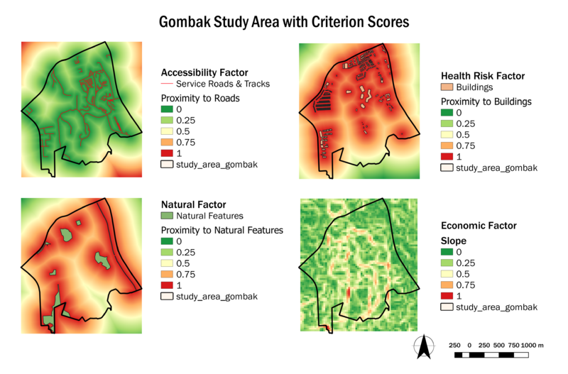
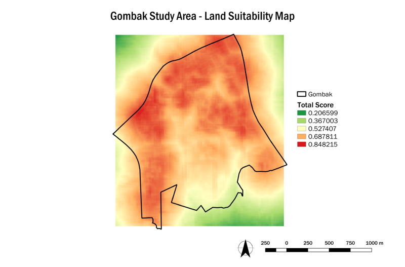
To identify a location in Gombak planning subzone that is suitable for building a National Communicable Disease Quarantine Centre, the following decision factors are studied in this report:
1. Accessibility Factor: The selected site should be close to existing service roads and tracks, to ensure the ease of transportation of resources during the construction of the Centre.
2. Health Risk Factor: The selected site should be away from the population in order to avoid the spread of the disease.
3. Natural Conservation Factor: The selected site should be away from forested land, park and water.
4. Economic Factor: The selected site should avoid steep slope to as it involves a lot of cut-and-fill which would lead to relatively higher development cost.
Data Source
| Name | Format | Source |
|---|---|---|
| Master Plan 2014 Subzone Boundary (No Sea) | SHP | data.gov |
| Roads, Buildings, Natural | SHP | OpenStreetMap |
| ASTER DEM | Raster | x |
