Difference between revisions of "SMT201 AY2019-20T1 EX1 Ng Xun Jie"
Jump to navigation
Jump to search
(editing of name) |
|||
| (4 intermediate revisions by 2 users not shown) | |||
| Line 2: | Line 2: | ||
== Part 1: Thematic Mapping== | == Part 1: Thematic Mapping== | ||
===== Distribution of Public Education Institution By School Types in Singapore ===== | ===== Distribution of Public Education Institution By School Types in Singapore ===== | ||
| + | [[File:Education.png|800px|center]] | ||
| + | I used 4 different symbols to represent the different categories of the education level in Singapore. It is apparent that mixed level ,JC and centralised institute are significantly smaller in numbers thus they cannot be seen easily on the map. I have thus increased the size of the symbol to make it stand out more. <br> | ||
| − | ===== | + | ===== Hierarchy of Road Network in Singapore ===== |
| − | ===== | + | ===== 2014 Master Plan Land Use in Singapore ===== |
== Part 2: Choropleth Mapping== | == Part 2: Choropleth Mapping== | ||
| − | ===== Choropleth Map of Aged | + | ===== Choropleth Map of Aged Population (+65) in 2010 and 2018 ===== |
| − | ===== Choropleth Map of | + | ===== Choropleth Map of Proportional of Aged Population in 2010 and 2018 ===== |
| − | ===== Choropleth Map | + | ===== Choropleth Map of Percentage Change of Aged Population between 2010 and 2018 ===== |
Latest revision as of 19:14, 14 September 2019
Part 1: Thematic Mapping
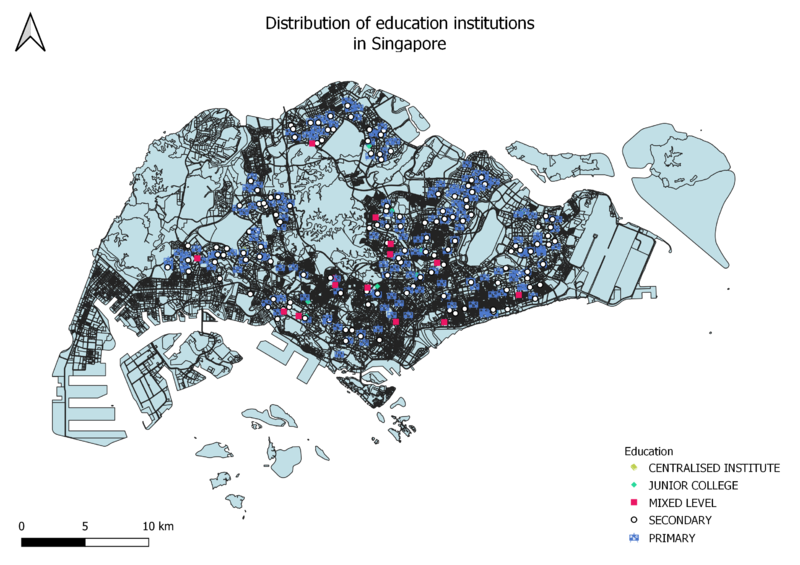
Distribution of Public Education Institution By School Types in Singapore

I used 4 different symbols to represent the different categories of the education level in Singapore. It is apparent that mixed level ,JC and centralised institute are significantly smaller in numbers thus they cannot be seen easily on the map. I have thus increased the size of the symbol to make it stand out more.