Difference between revisions of "SMT201 AY2018-19T1 EX2 Lim Qiu Hui Candy"
Jump to navigation
Jump to search


| (5 intermediate revisions by the same user not shown) | |||
| Line 1: | Line 1: | ||
| − | == | + | == Overall Map Views == |
| − | [[File: | + | [[File:Qn1_edited2.png|700px|center]] |
| − | === | + | === Roads in Gombak === |
| + | hihi | ||
| + | === Buildings in Gombak === | ||
| + | hihi | ||
| + | === Natural Features in Gombak === | ||
| + | === Elevation of Gombak === | ||
| + | |||
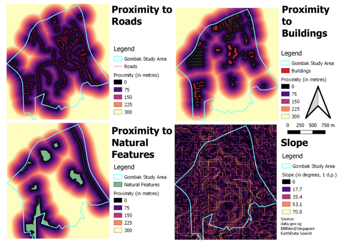
| + | == Overall Proximity Map Views == | ||
| + | [[File:Qn2 edited.png|700px|center]] | ||
| + | === Proximity to Roads in Gombak === | ||
| + | === Proximity to Buildings in Gombak === | ||
| + | === Proximity to Natural Features in Gombak === | ||
| + | === Slope of Gombak === | ||
| + | |||
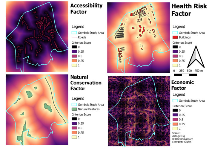
| + | == Overall Criterion Score Map Views == | ||
| + | [[File:Qn3.png|700px|center]] | ||
| + | === Accessibility Factor === | ||
| + | === Health Risk Factor === | ||
| + | === Natural Conservation Factor === | ||
| + | === Economic Factor === | ||
| + | |||
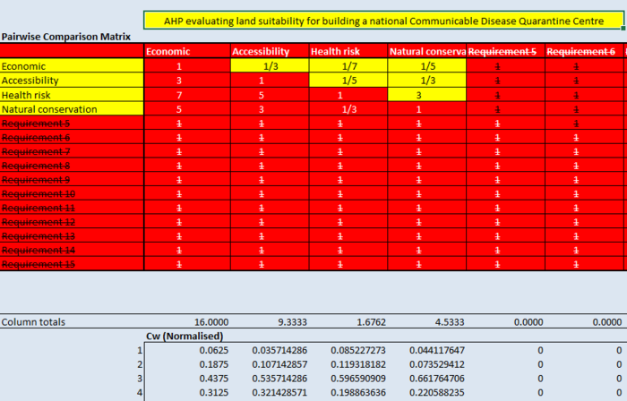
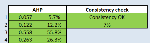
| + | == AHP Input Matrix and Results == | ||
| + | [[File:AHP part 1.png|700px|center]] | ||
| + | [[File:AHP part 2.png|center]] | ||
| + | |||
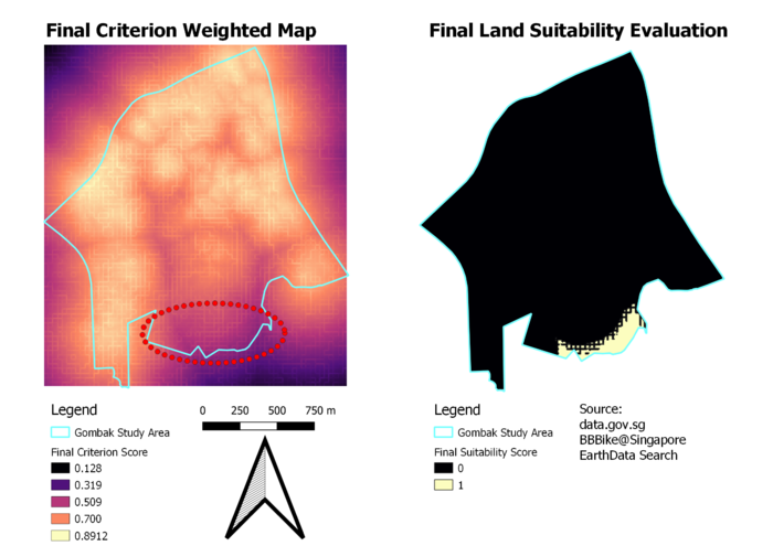
| + | == Final Land Suitability Evaluation == | ||
| + | [[File:Qn5.png|700px|center]] | ||
| + | [[File:Qn5-1.png|700px|center]] | ||
Latest revision as of 21:35, 10 November 2019
Contents
Overall Map Views

Roads in Gombak
hihi
Buildings in Gombak
hihi
Natural Features in Gombak
Elevation of Gombak
Overall Proximity Map Views

Proximity to Roads in Gombak
Proximity to Buildings in Gombak
Proximity to Natural Features in Gombak
Slope of Gombak
Overall Criterion Score Map Views

Accessibility Factor
Health Risk Factor
Natural Conservation Factor
Economic Factor
AHP Input Matrix and Results


Final Land Suitability Evaluation

