Difference between revisions of "SMT201 AY2019-20G2 Ex2 Lee Sean Jin"
| Line 26: | Line 26: | ||
= Criterion Scores = | = Criterion Scores = | ||
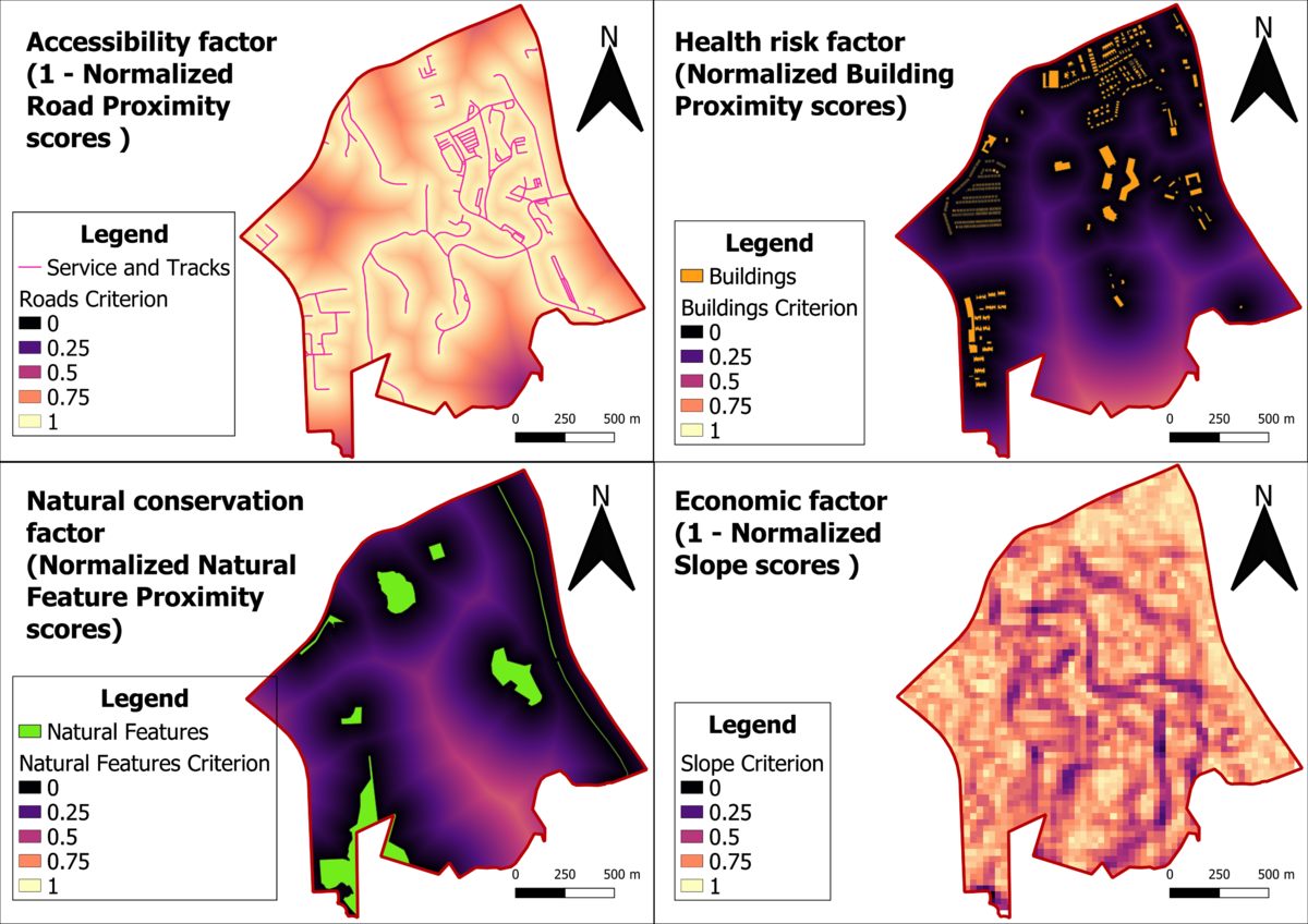
<div class="center" style="width: auto; margin-left: auto; margin-right: auto;">'''Criterion scores of the Proximity to Roads, Buildings, Natural Features and Slope Analysis '''</div> | <div class="center" style="width: auto; margin-left: auto; margin-right: auto;">'''Criterion scores of the Proximity to Roads, Buildings, Natural Features and Slope Analysis '''</div> | ||
| − | [[File:TakeHome02 Map3.png|1200px|thumb | + | [[File:TakeHome02 Map3.png|1200px|thumb|center|Data Source: Master Plan 2014 Subzone Boundary (No Sea) (SHP) from URA [https://data.gov.sg/dataset/master-plan-2014-subzone-boundary-no-sea]. Roads, Buildings and Natural (SHP) from OpenStreetMap [https://download.bbbike.org/osm/bbbike/Singapore/]. ASTER Global Digital Elevation Model (GDEM) dataset jointly prepared by NASA and METI, Japan [https://search.earthdata.nasa.gov/search?m=-7.175!25.59375!1!1!0!0%2C2]]] |
= Analytical Hierarchical Process input matrix and result report = | = Analytical Hierarchical Process input matrix and result report = | ||
[[File:AHPResults.png|1200px|thumb|center|Template provided by SCB Associates [https://www.google.com/url?sa=t&rct=j&q=&esrc=s&source=web&cd=17&ved=2ahUKEwi198HV87_lAhXhjuYKHWn1AnEQFjAQegQICRAC&url=http%3A%2F%2Fwww.scbuk.com%2FAHP%2520Template%2520SCBUK.xls&usg=AOvVaw002J8QfYIxOE_I9PYqrH8_]]] | [[File:AHPResults.png|1200px|thumb|center|Template provided by SCB Associates [https://www.google.com/url?sa=t&rct=j&q=&esrc=s&source=web&cd=17&ved=2ahUKEwi198HV87_lAhXhjuYKHWn1AnEQFjAQegQICRAC&url=http%3A%2F%2Fwww.scbuk.com%2FAHP%2520Template%2520SCBUK.xls&usg=AOvVaw002J8QfYIxOE_I9PYqrH8_]]] | ||
Revision as of 17:51, 10 November 2019
Contents
Objective
To identify a location suitable for building a National Communicable Disease Quarantine Centre. The selected site is located in the Gombak planning subzone, with a contiguous area of at least 10,000m2 and it must meet the following decision factors:
1. Economic factor: The selected site should avoid steep slope. This is because construction at steep slope tends to involve a lot of cut-and-fill and will lend to relatively higher development cost.
2. Accessibility factor: The selected site should be close to existing local roads, namely: service roads and tracks. This is to ensure easy transportation of building materials during the construction stage.
3. Health risk factor: The selected site should be away from population i.e. housing areas and offices in order to avoid disease spreading to the nearby population.
4. Natural conservation factor: The selected site should be away from forested land, park and water.
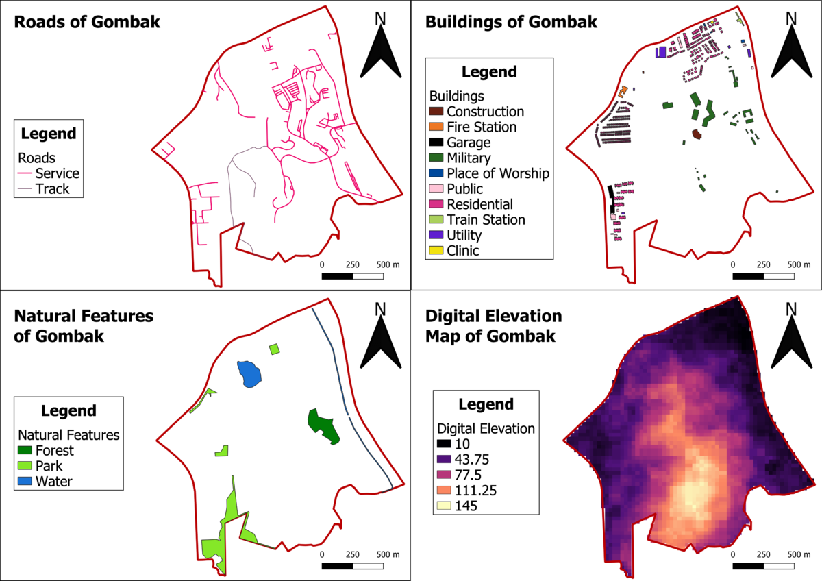
The main features of analysis as identified above will be as follows:
1. The Digital Elevation Map of Gombak.
2. Service roads and tracks in Gombak.
3. Buildings that has human traffic on a daily basis in Gombak.
4. Natural features containing forested land, parks and water bodies in Gombak.
Analysis of the features identified above
Criterion Scores
Analytical Hierarchical Process input matrix and result report


