Difference between revisions of "SMT201 AY2019-20G1 EX2 Seah Si Qi Christel"
Sqseah.2018 (talk | contribs) (Created page with "https://wiki.smu.edu.sg/1920t1smt201/SMT201_AY2018-19T1_EX2_Seah_Si_Qi_Christel") |
Sqseah.2018 (talk | contribs) |
||
| Line 1: | Line 1: | ||
[[https://wiki.smu.edu.sg/1920t1smt201/SMT201_AY2018-19T1_EX2_Seah_Si_Qi_Christel]] | [[https://wiki.smu.edu.sg/1920t1smt201/SMT201_AY2018-19T1_EX2_Seah_Si_Qi_Christel]] | ||
| + | |||
| + | ===Q1. Map View with Study Area and Target Roads, Buildings, Natural Features, Digital Elevations Layer=== | ||
| + | |||
| + | <br> | ||
| + | <br> | ||
| + | [[File:Gombak Buildings.png|600px|frameless|center]] | ||
| + | [[File:Roads in gombak.png|600px|frameless|center]] | ||
| + | [[File:Natural.png|600px|frameless|center]] | ||
| + | [[File:Digital elevation.png|600px|frameless|center]] | ||
| + | <br> | ||
| + | <br> | ||
| + | |||
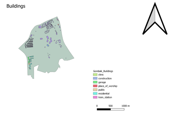
| + | '''Buildings:''' If the National Communicable Disease Centre were to be located in Gombak area, it should not be located near the general populace to prevent the risk of diseases being transmitted. Disease Centres which serves as quarantine sites, as far as possible should be located away from the general populace | ||
| + | |||
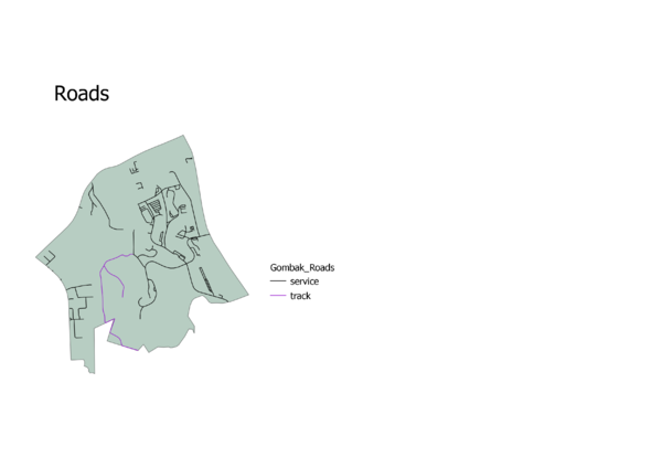
| + | '''Target Roads:'''To build the National Communicable Disease Centre, it should be located on the Eastern side of Gombak planning area where there is a higher density of service and track roads. The benefit of being located to road networks is that it allows for the easier transportation of building materials during the construction stage, making the construction process more efficient and effectively savings costs | ||
| + | |||
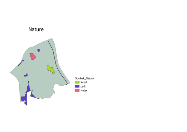
| + | '''Natural Conservation:''' The National Communicable Disease Centre should be located away from natural conservation sites to reduce the likelihood of diseases entering the water bodies of Singapore. Furthermore, these nature spots are where many Singaporeans engage in recreational activities, increasing the risk of diseases being transmitted. | ||
| + | |||
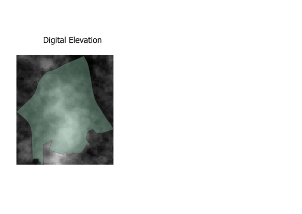
| + | '''Digital Elevation:''' Steepness of slope is determined by the closeness of the contour lines. The South Central area is where the contour lines are most dense. The National Communicable Disease Centre should not be constructed on such a terrain as construction costs too would be steeper because of the additional considerations to work around construction on a slope. | ||
Revision as of 17:15, 10 November 2019
[[1]]
Q1. Map View with Study Area and Target Roads, Buildings, Natural Features, Digital Elevations Layer
Buildings: If the National Communicable Disease Centre were to be located in Gombak area, it should not be located near the general populace to prevent the risk of diseases being transmitted. Disease Centres which serves as quarantine sites, as far as possible should be located away from the general populace
Target Roads:To build the National Communicable Disease Centre, it should be located on the Eastern side of Gombak planning area where there is a higher density of service and track roads. The benefit of being located to road networks is that it allows for the easier transportation of building materials during the construction stage, making the construction process more efficient and effectively savings costs
Natural Conservation: The National Communicable Disease Centre should be located away from natural conservation sites to reduce the likelihood of diseases entering the water bodies of Singapore. Furthermore, these nature spots are where many Singaporeans engage in recreational activities, increasing the risk of diseases being transmitted.
Digital Elevation: Steepness of slope is determined by the closeness of the contour lines. The South Central area is where the contour lines are most dense. The National Communicable Disease Centre should not be constructed on such a terrain as construction costs too would be steeper because of the additional considerations to work around construction on a slope.


