Difference between revisions of "SMT201 AY2019-20G2 Ex1 LoisLek"
Jump to navigation
Jump to search
| Line 2: | Line 2: | ||
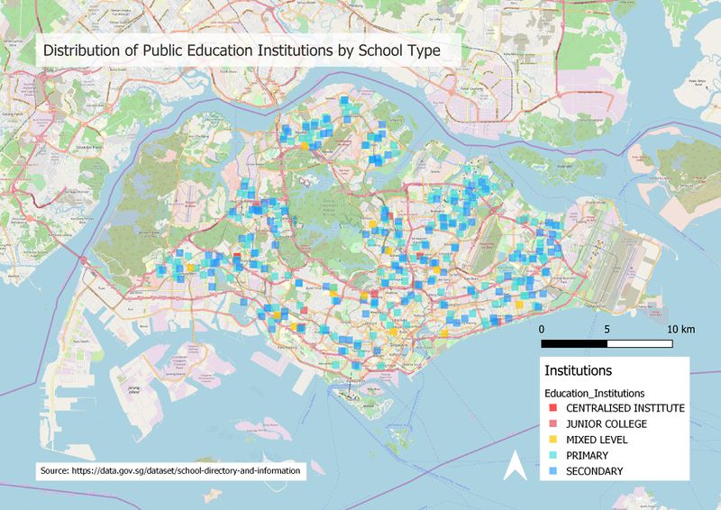
<p> Distribution of Public Education Institutions by School Type </p> | <p> Distribution of Public Education Institutions by School Type </p> | ||
| + | |||
[[File:Education Institutions.jpg|thumb|Distribution of Public Education Institutions by School Type| left| 800px]] <br> | [[File:Education Institutions.jpg|thumb|Distribution of Public Education Institutions by School Type| left| 800px]] <br> | ||
| + | |||
| + | <p> The data used for the Education Institutions is the School Directory data from Data.gov. <p> | ||
