Difference between revisions of "SMT201 AY2019-20T1 EX2 Tay Jing Wen"
Jump to navigation
Jump to search
| Line 17: | Line 17: | ||
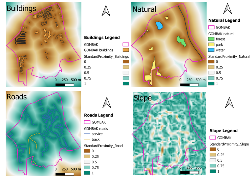
== PART 3: Criterion Score == | == PART 3: Criterion Score == | ||
| + | [[File:Standardized Format.png|1000x1000px|frameless|center]] | ||
| + | <br> | ||
<br><br> | <br><br> | ||
Revision as of 14:05, 10 November 2019
Contents
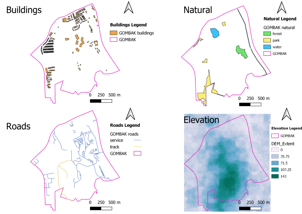
PART 1: Gombak and the 4 Target Views

Description
Buildings:
Natural:
Roads:
Digital Elevation:
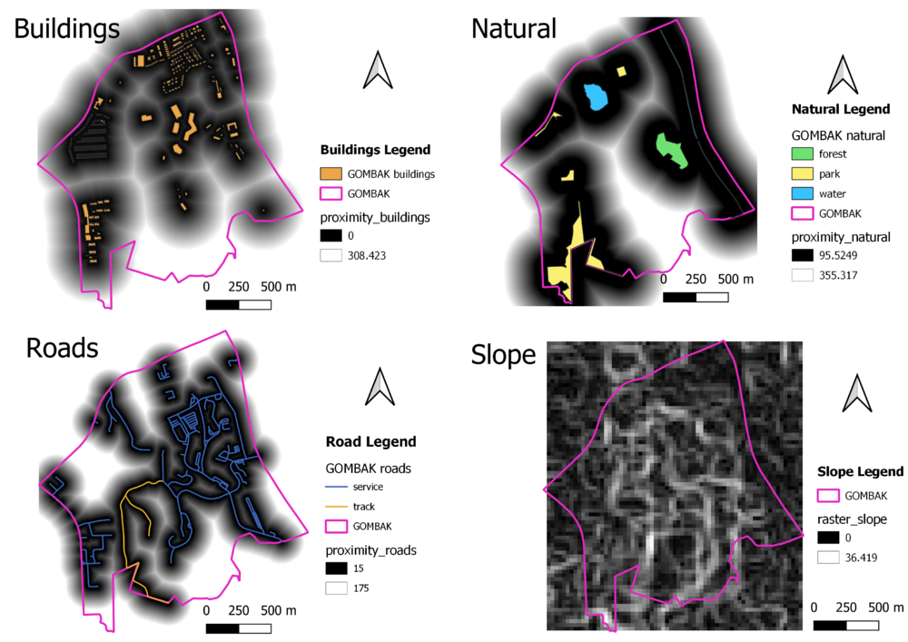
PART 2: Gombak and the 4 Proximity Views

Description
Buildings:
Natural:
Roads:
Slope:
PART 3: Criterion Score

PART 4: Analytical Hierarchical Process Input Matrix
PART 5: Suitability Land Lot