Difference between revisions of "SMT201 AY2018-19T1 EX2 Tan Jie Ting Christine"
Jump to navigation
Jump to search
Jttan.2018 (talk | contribs) |
Jttan.2018 (talk | contribs) |
||
| (One intermediate revision by the same user not shown) | |||
| Line 28: | Line 28: | ||
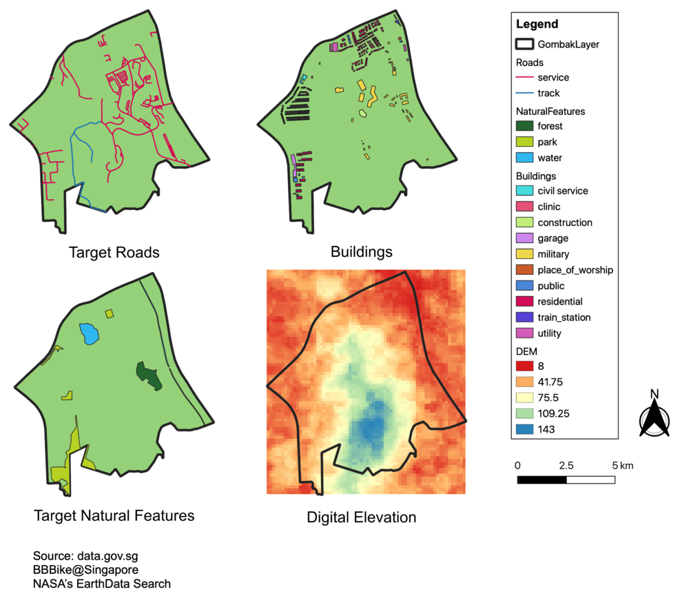
| − | === | + | === Maps === |
| − | |||
| − | + | [[File:4maps1.png|1000px|thumb|center]] | |
| − | [[File: | ||
| − | |||
| − | |||
| − | |||
| − | |||
| − | |||
| − | |||
Latest revision as of 15:52, 7 November 2019
|
Overview |
