Difference between revisions of "G2-Group11"
Jump to navigation
Jump to search


Zw.wang.2016 (talk | contribs) |
Zw.wang.2016 (talk | contribs) |
||
| Line 33: | Line 33: | ||
<!-- DATA ---> | <!-- DATA ---> | ||
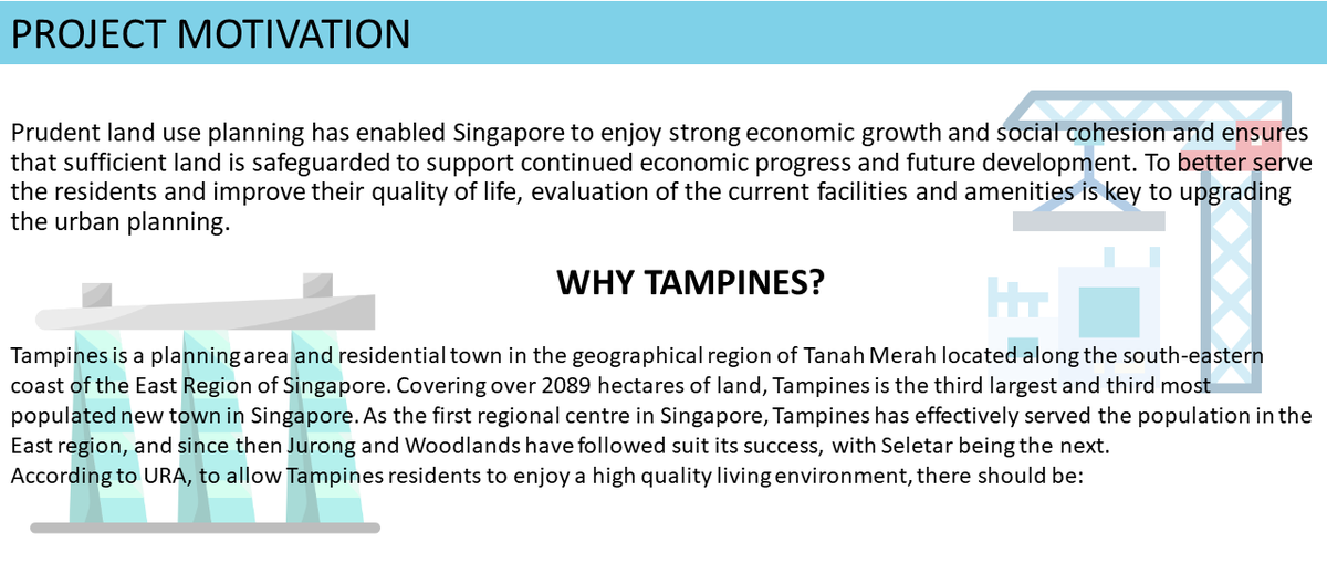
| − | + | [[File:MasterPlannerSlide11.jpg|1200px|center]] | |
{| class="wikitable" style="background-color:#FFFFFF;" width="100%" | {| class="wikitable" style="background-color:#FFFFFF;" width="100%" | ||
| Line 110: | Line 110: | ||
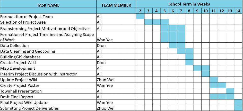
<!-- PROJECT TIMELINE ---> | <!-- PROJECT TIMELINE ---> | ||
| − | + | ||
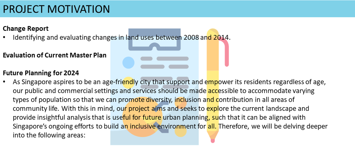
| − | + | [[File:MasterPlannerSlide9.jpg|1200px|center]] | |
| − | [[File:MasterPlannerSlide7.jpg| | + | [[File:MasterPlannerSlide7.jpg|1000px|center]] |
<br> | <br> | ||
<!-- END OF PROJECT TIMELINE ---> | <!-- END OF PROJECT TIMELINE ---> | ||
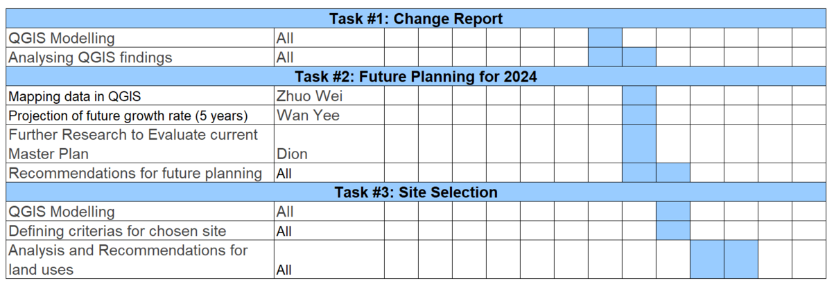
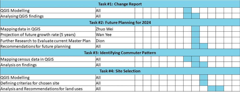
<!-- SCOPE OF WORK ---> | <!-- SCOPE OF WORK ---> | ||
| − | + | [[File:MasterPlannerSlide10.jpg|1200px|center]] | |
| − | + | [[File:MasterPlannerSlide8.jpg|1000px|center]] | |
| − | [[File:MasterPlannerSlide8.jpg| | ||
<br> | <br> | ||
<!-- END OF SCOPE OF WORK ---> | <!-- END OF SCOPE OF WORK ---> | ||
Revision as of 14:34, 25 October 2019

|
|
|
|
|


