Difference between revisions of "SMT201 AY2018-19T1 EX1 Aaron Lee Tian En"
Jump to navigation
Jump to search


| Line 9: | Line 9: | ||
[[File:Road Network System.jpg|350px|left]] | [[File:Road Network System.jpg|350px|left]] | ||
| − | |||
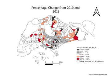
| − | + | == Part Two: Choropleth Mapping == | |
| − | [[Image: | + | [[Image:2010 Proportion Aged65+.jpg|350px|left]] |
| − | [[Image: | + | [[Image:2018 Proportion Aged65+.jpg|350px|left]] |
| − | [[Image: | + | [[Image:2010 Aged65+ Population.jpg|350px|left]] |
| − | [[File:Percentage Change From 2010 and 2018.jpg|350px| | + | [[Image:2018 Aged65+ Population.jpg|350px|left]] |
| + | |||
| + | [[File:Percentage Change From 2010 and 2018.jpg|350px|left]] | ||
Revision as of 22:03, 13 September 2019
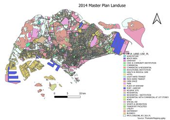
Part One: Thematic Mapping
2014 Master Plan Landuse


Part Two: Choropleth Mapping


