Difference between revisions of "SMT201 AY2019-20T1 EX1 Wang Youjin"
| Line 36: | Line 36: | ||
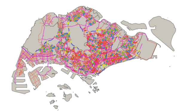
Different color lines and width are used to represent different types of road with cateogirized technique performed on the map line layer use | Different color lines and width are used to represent different types of road with cateogirized technique performed on the map line layer use | ||
| − | [[File:WYJ Road Network.png| | + | [[File:WYJ Road Network.png|600px|center]]<br> |
<p class=MsoNormal align=center style='text-align:center;line-height:normal'><span | <p class=MsoNormal align=center style='text-align:center;line-height:normal'><span | ||
lang=EN-GB style='font-size:8.0pt;font-family:"Times New Roman",serif; | lang=EN-GB style='font-size:8.0pt;font-family:"Times New Roman",serif; | ||
| Line 52: | Line 52: | ||
| 3. data.gov - “MP14_SUBZONE_NO_SEA_PL” || Layer: MP14_SUBZONE_NO_SEA_PL | | 3. data.gov - “MP14_SUBZONE_NO_SEA_PL” || Layer: MP14_SUBZONE_NO_SEA_PL | ||
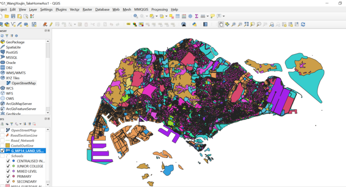
| − | + | Categorization technique is used to indicate the land used for different purpose. | |
| − | |||
<brt | <brt | ||
| − | [[File: | + | [[File:Wyj Landuse.PNG|700px|center]] |
<p class=MsoNormal align=center style='text-align:center;line-height:normal'><span | <p class=MsoNormal align=center style='text-align:center;line-height:normal'><span | ||
lang=EN-GB style='font-size:8.0pt;font-family:"Times New Roman",serif; | lang=EN-GB style='font-size:8.0pt;font-family:"Times New Roman",serif; | ||
Revision as of 18:42, 15 September 2019
Part 1: Thematic Mapping
Explain how the mapping were developed with elaboration:
| Data | QGIS Techniques | ||||||
|---|---|---|---|---|---|---|---|
| 1.data.gov - “School Directory and Information” |
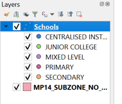
New Layer created: Schools created from csv file using Geocoding tool MMQGIS plugin. 'Address' attribute is used for openstreet map projection Distribution of school types: Under Symbology, select categoriszation by `mainlevel_` attribute.Different colors are used to indication different school types for easy illustrative reference purpose School types
Data not found CSV from geocoding: | ||||||
| 2.data.gov - “Masterplan 2014 Landuse” "National Map Line"
SLA - "Road Selection Line" |
Layer Imported: Land Use, Road Selection Line, National Map Line Different color lines and width are used to represent different types of road with cateogirized technique performed on the map line layer use Road Network
| ||||||
| 3. data.gov - “MP14_SUBZONE_NO_SEA_PL” | Layer: MP14_SUBZONE_NO_SEA_PL
Categorization technique is used to indicate the land used for different purpose. <brt FIGURE IV OVERVIEW OF THEMATIC MAPPING
Part 2: Choropleth Mapping[[File:|center]] FIGURE VIII LAYERS EXPORTED The choropleth mapping developed uses these following data and applied techniques: Sources and Methods
|


