Difference between revisions of "SMT201 AY2018-19T1 EX1 Tan Yan Bin Kelvin"
Jump to navigation
Jump to search

Jttan.2018 (talk | contribs) |
Jttan.2018 (talk | contribs) |
||
| Line 1: | Line 1: | ||
| − | |||
= Part 1: Thematic Mapping = | = Part 1: Thematic Mapping = | ||
Revision as of 15:31, 15 September 2019
Part 1: Thematic Mapping
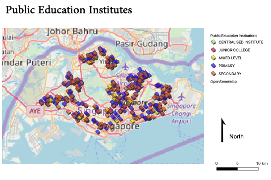
Public Education Institutes
I used a different colour to represent the different types of public education institutes as shown below, so that it is easy for people to identify the type of school by the colour. I used simple markers so that we can see where the schools are located on the map. I also made the symbols less opaque so that you can see if there happens to be symbols that overlay on each other.

Hierarchy of Road Network Systems
I used different colours and thickness for the different road types to show the hierarchy of the road network systems. For example, I used a green line with a width of 1.50 for the expressway, and a dark pink line with a width of 0.50 for the major line. The difference in the width shows the difference in the levels of traffic the road can contain.
