Difference between revisions of "SMT201 AY2019-20T1 EX1 Tan Wei Long Ryan"
Jump to navigation
Jump to search


| Line 19: | Line 19: | ||
== Part Two: Choropleth Mapping == | == Part Two: Choropleth Mapping == | ||
| − | === | + | === Singapore's Aged Population (65+) in 2010 === |
[[File:AgedPopulation 2010.png|800px|center]] | [[File:AgedPopulation 2010.png|800px|center]] | ||
xxxxx | xxxxx | ||
<br> | <br> | ||
| − | === | + | === Singapore's Aged Population (65+) in 2018 === |
| + | [[File:AgedPopulation 2018.png|800px|center]] | ||
<br> | <br> | ||
| − | === | + | === Proportion of Singapore's Aged Population in 2010 === |
<br> | <br> | ||
| − | === | + | === Proportion of Singapore's Aged Population in 2018 === |
<br> | <br> | ||
| − | === Percentage Change of Aged Population From 2010 | + | === Percentage Change of Aged Population From 2010 to 2018 === |
Revision as of 15:14, 15 September 2019
Part One: Thematic Mapping
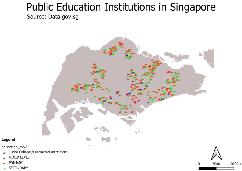
Distribution of Public Education Institutions in Singapore

xxxx this xxxx
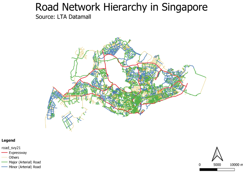
Hierarchy of Road Network System in Singapore

xxxx aa12321
2014 Master Plan Landuse

xxxx this xxxx
Part Two: Choropleth Mapping
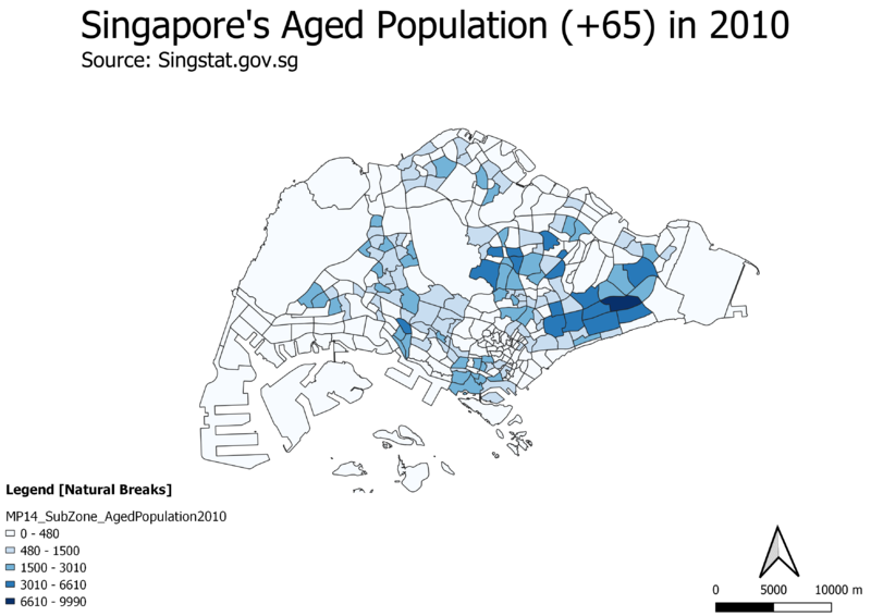
Singapore's Aged Population (65+) in 2010

xxxxx
Singapore's Aged Population (65+) in 2018

Proportion of Singapore's Aged Population in 2010
Proportion of Singapore's Aged Population in 2018