Difference between revisions of "Proximity s"

From Geospatial Analytics for Urban Planning
Jump to navigation Jump to search
Line 25: Line 25:
 
<br>
 
<br>
  
[[File:Proximity sher.png|900px|thumb|center|'''Gombak Study Area with Proximity Map of:<br>- Roads (Top Left)<br>- Buildings (Top Right)<br>- Natural Features (Bottom Left)<br>- Slope (Bottom Right)''']]
+
[[File:Proximity sl.png|900px|thumb|center|'''Gombak Study Area with Proximity Map of:<br>- Roads (Top Left)<br>- Buildings (Top Right)<br>- Natural Features (Bottom Left)<br>- Slope (Bottom Right)''']]

Revision as of 03:25, 11 November 2019

Overview

Proximity


Criterion Score


AHP

  Suitability


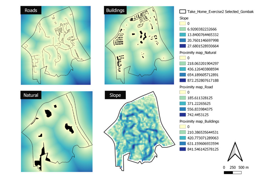
Gombak Study Area with Proximity Map of:
- Roads (Top Left)
- Buildings (Top Right)
- Natural Features (Bottom Left)
- Slope (Bottom Right)