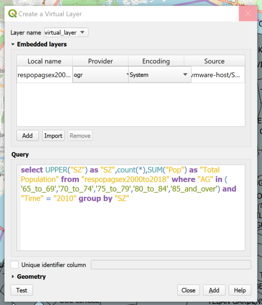
File:Virtual Layer.png
Jump to navigation
Jump to search

Size of this preview: 516 × 600 pixels. Other resolutions: 206 × 240 pixels | 939 × 1,091 pixels.
Original file (939 × 1,091 pixels, file size: 112 KB, MIME type: image/png)
Virtual Layer
File history
Click on a date/time to view the file as it appeared at that time.
| Date/Time | Thumbnail | Dimensions | User | Comment | |
|---|---|---|---|---|---|
| current | 00:04, 14 September 2019 | | 939 × 1,091 (112 KB) | Kelvin.chia.2017 (talk | contribs) |
- You cannot overwrite this file.
File usage
The following 2 pages link to this file: