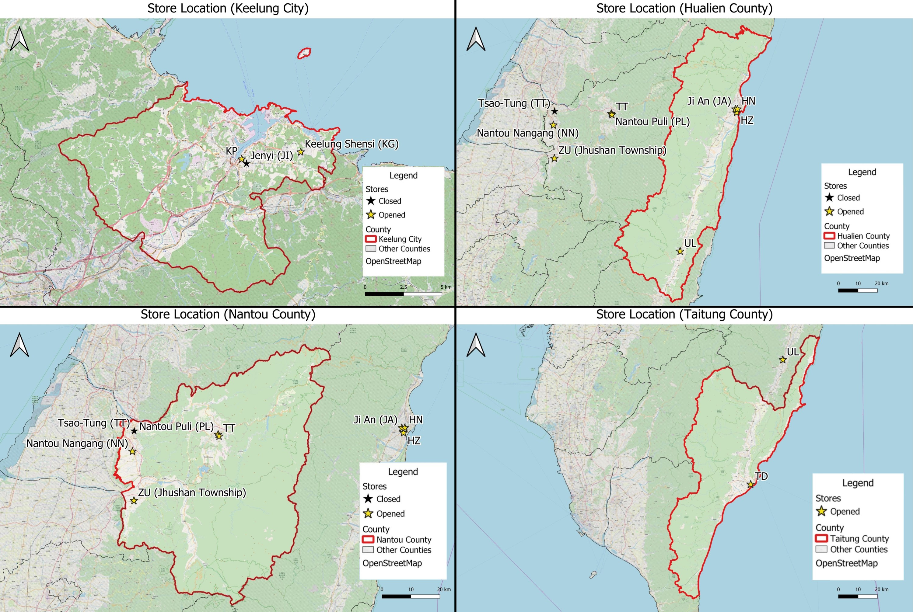
File:TWCounty1.jpg
Jump to navigation
Jump to search

Size of this preview: 800 × 537 pixels. Other resolutions: 320 × 215 pixels | 3,000 × 2,012 pixels.
Original file (3,000 × 2,012 pixels, file size: 1.33 MB, MIME type: image/jpeg)
county1
File history
Click on a date/time to view the file as it appeared at that time.
| Date/Time | Thumbnail | Dimensions | User | Comment | |
|---|---|---|---|---|---|
| current | 13:04, 17 October 2019 | | 3,000 × 2,012 (1.33 MB) | Yunyu.chong.2018 (talk | contribs) | Increase legibility of legend |
| 23:43, 16 October 2019 |  | 1,280 × 858 (201 KB) | Brendan.ong.2018 (talk | contribs) |
- You cannot overwrite this file.
File usage
There are no pages that use this file.