File:Roadnetwork.jpg
Jump to navigation
Jump to search

Size of this preview: 800 × 566 pixels. Other resolutions: 320 × 226 pixels | 3,507 × 2,480 pixels.
Original file (3,507 × 2,480 pixels, file size: 1.28 MB, MIME type: image/jpeg)
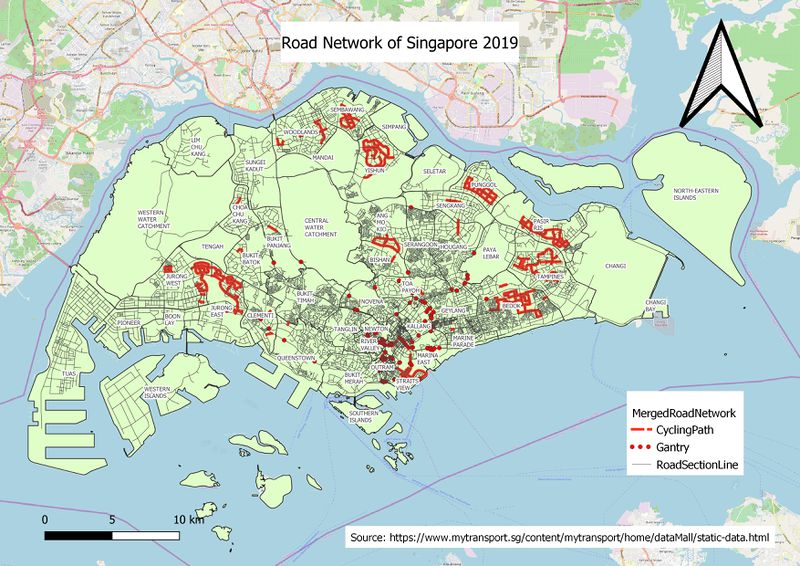
The map above merges different vector layers of RoadSectionLine which I visualize as a simple line, Gantry as the red dot and Cycling Path as red hashed line, although it looks like a solid line from this scale.
File history
Click on a date/time to view the file as it appeared at that time.
| Date/Time | Thumbnail | Dimensions | User | Comment | |
|---|---|---|---|---|---|
| current | 04:10, 15 September 2019 | | 3,507 × 2,480 (1.28 MB) | Erikaaldisa.2018 (talk | contribs) |
- You cannot overwrite this file.
File usage
There are no pages that use this file.