File:Road Network System .png
Jump to navigation
Jump to search

Size of this preview: 800 × 558 pixels. Other resolutions: 320 × 223 pixels | 1,342 × 936 pixels.
Original file (1,342 × 936 pixels, file size: 1.34 MB, MIME type: image/png)
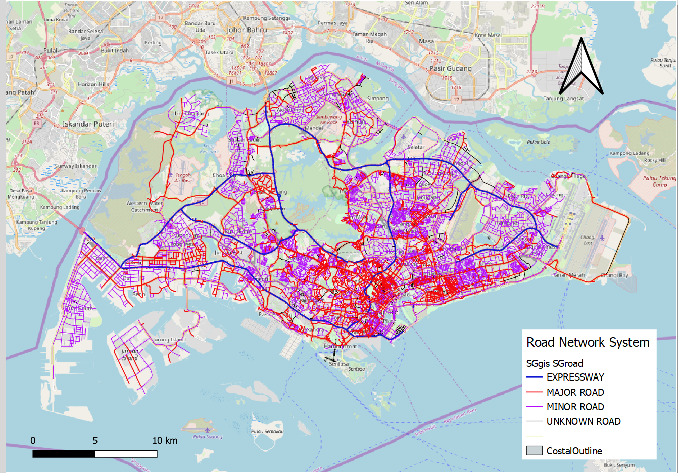
Based on the data collected from data.gov.sg, users are able to visualise the different type of roads in Singapore.
File history
Click on a date/time to view the file as it appeared at that time.
| Date/Time | Thumbnail | Dimensions | User | Comment | |
|---|---|---|---|---|---|
| current | 20:34, 15 September 2019 | | 1,342 × 936 (1.34 MB) | Jaslyn.wong.2017 (talk | contribs) |
- You cannot overwrite this file.
File usage
The following page links to this file: